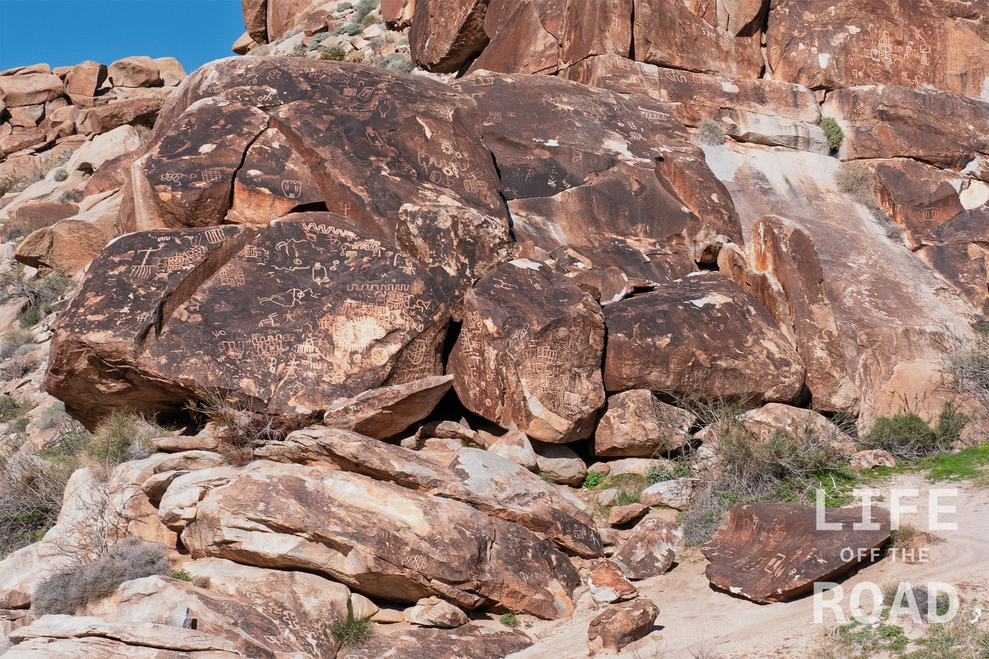
Just north of Laughlin, NV on Christmas Tree Pass Road are the Grapevine Canyon Petroglyphs. These were some of the best petroglyphs that I have seen outside of Utah, and are well worth the short drive and easy hike into the canyon.
Author: Roy Scribner
-
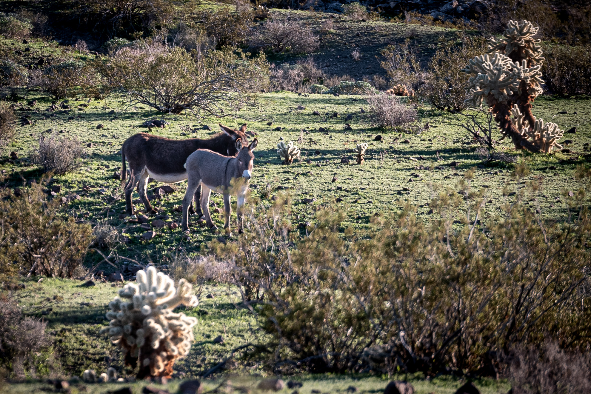
Burros in Oatman, Arizona
I recently spent the night outside of Oatman, Arizona and had a few guests meandering around my campsite, which was well off the beaten path in a box canyon. These two were very quiet, but other burros in the area were bellowing all night long.
-
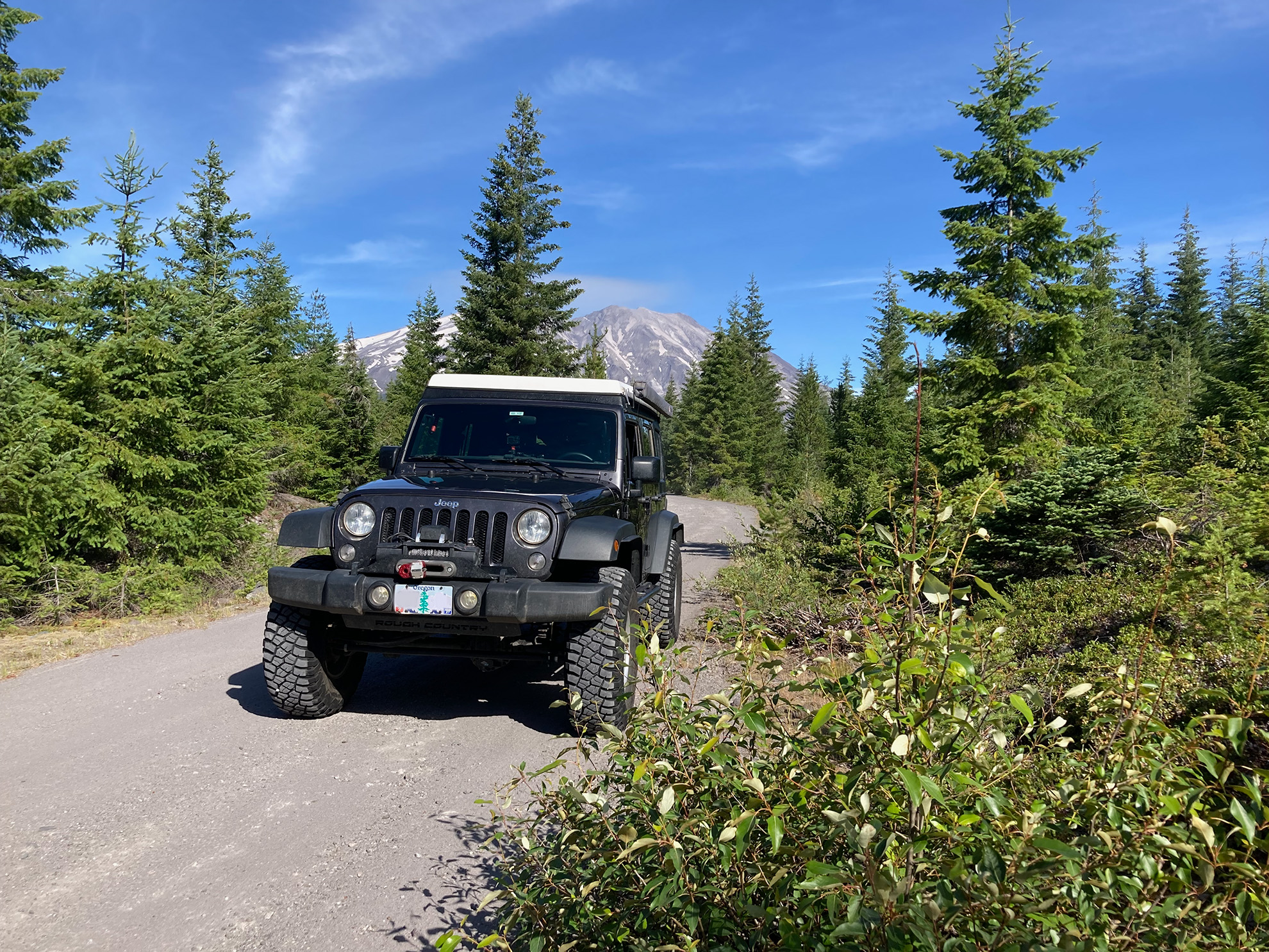
South of Mount Saint Helens
This was on a forest road south of Mount Saint Helens in July of 2025. I was attempting to get back down through the Gifford Pinchot National Forest to Stevenson or Carson but alas, I ran into a locked gate. It was not a complete loss, however, as I found some of the best views of the mountain from a small spur road. As winter sets in here in the Pacific Northwest, trips like this become very difficult as roads such as this one close for the season. Soon I will be off to southern Nevada for another trip with some friends, though.
-
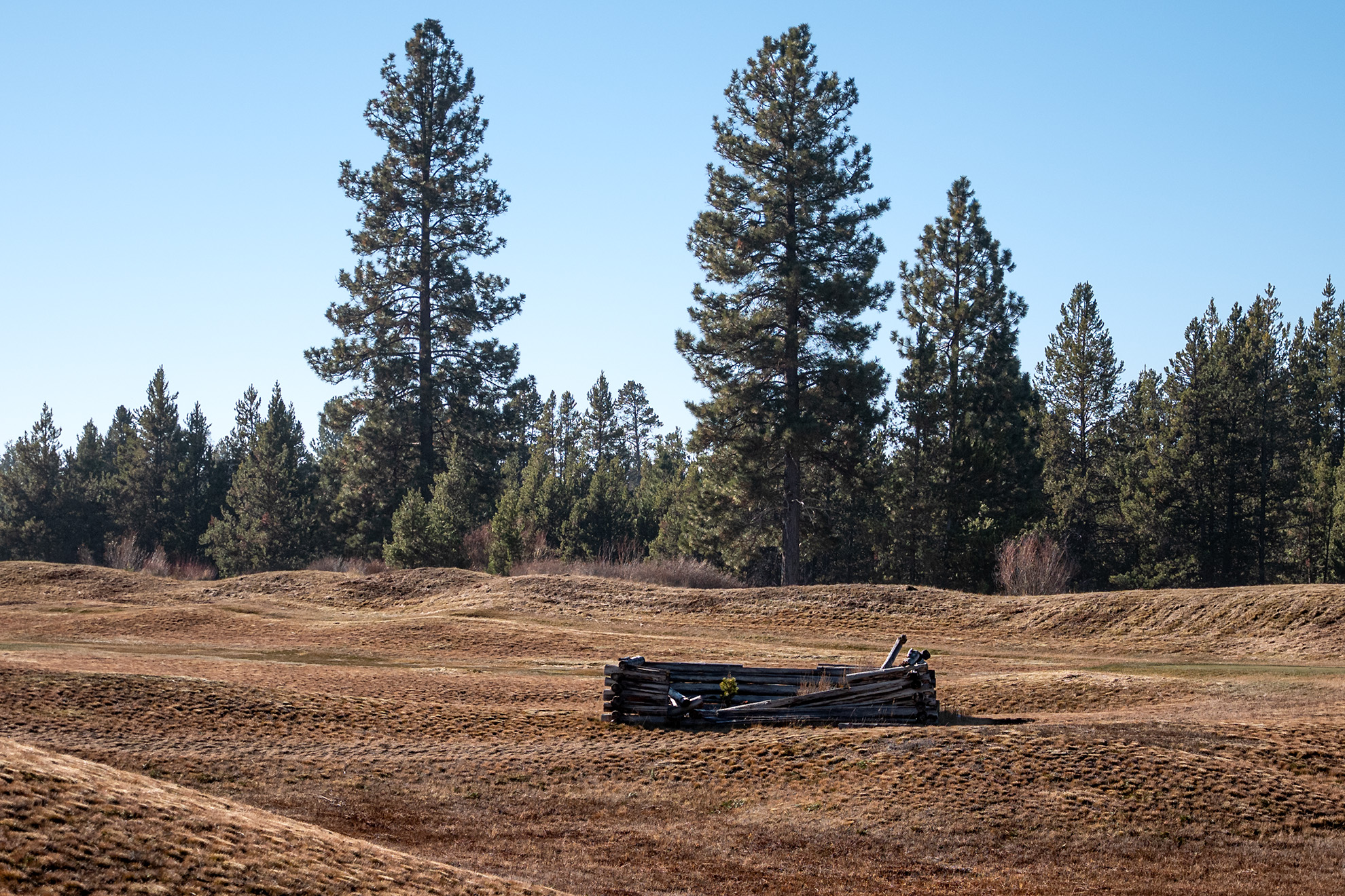
Caldera Springs
Not my normal photographic subject, but I happened to be taking a morning hike around Caldera Springs which is a resort community south of Bend, Oregon and I happened on this setting, along one of its golf course holes. Despite its modernity, I found it picturesque with the two tall pines in the background. It is a slow time of year for off-road travel with the holiday’s, but soon after the New Year I have plans to meet up with Kitt from Seattle and hopefully several other adventurers, for some desert driving in southern Nevada. Here we are in late November and it seems like just yesterday that I was picking my way through the snow drifts remaining in the Three Creek Lake area between Bend and Sisters. As we head into the Thanksgiving holiday here in the U.S. I am busy fitting additional skid plates to the underside of the jeep, in preparation for the Jeepers Jamboree in July. I am not one for crowds, but I am also not one for tackling the Rubicon Trail on my own, so I thought that this would be the easiest way to gain some experience on the fabled trail.
-
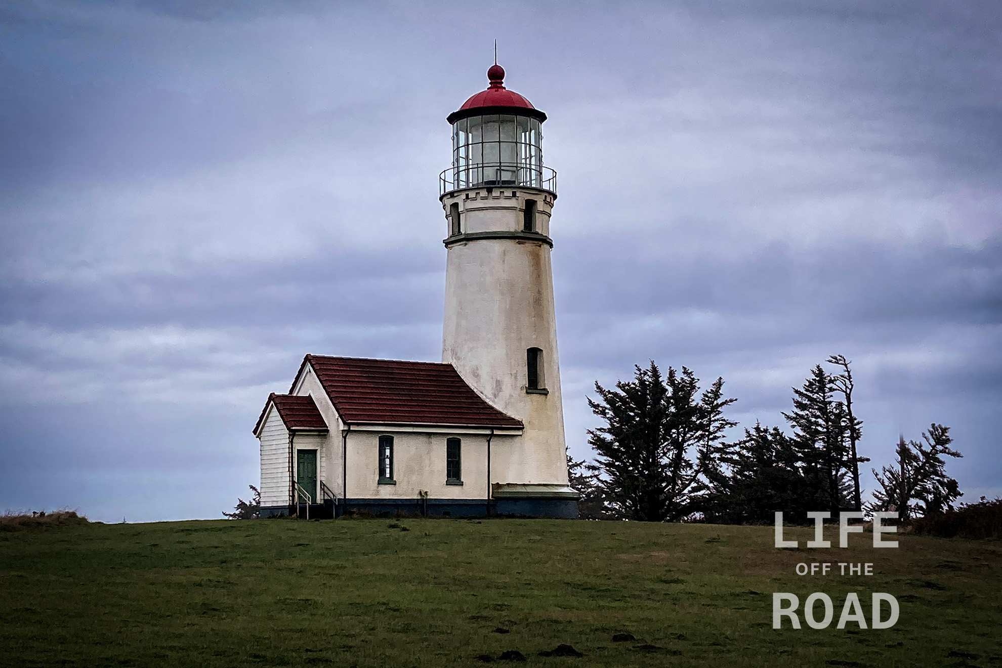
Cape Blanco Lighthouse
The lighthouse at Cape Blanco is one of the oldest continuously operating lighthouses on the west coast, signaling mariners since December 20, 1870 (Point Pinos in Pacific Grove, California went into operation on February 1, 1855). If not the oldest, it is certainly one of the highest; perched atop the 200-foot (61 meters) cliffs of Cape Blanco. The tower itself is 50-feet (15.24 meters) tall. Unlike some of the other lighthouses on the Oregon Coast, there are no public tours inside the lighthouse, but you are free to walk the grounds and there is nearby visitors center.
-
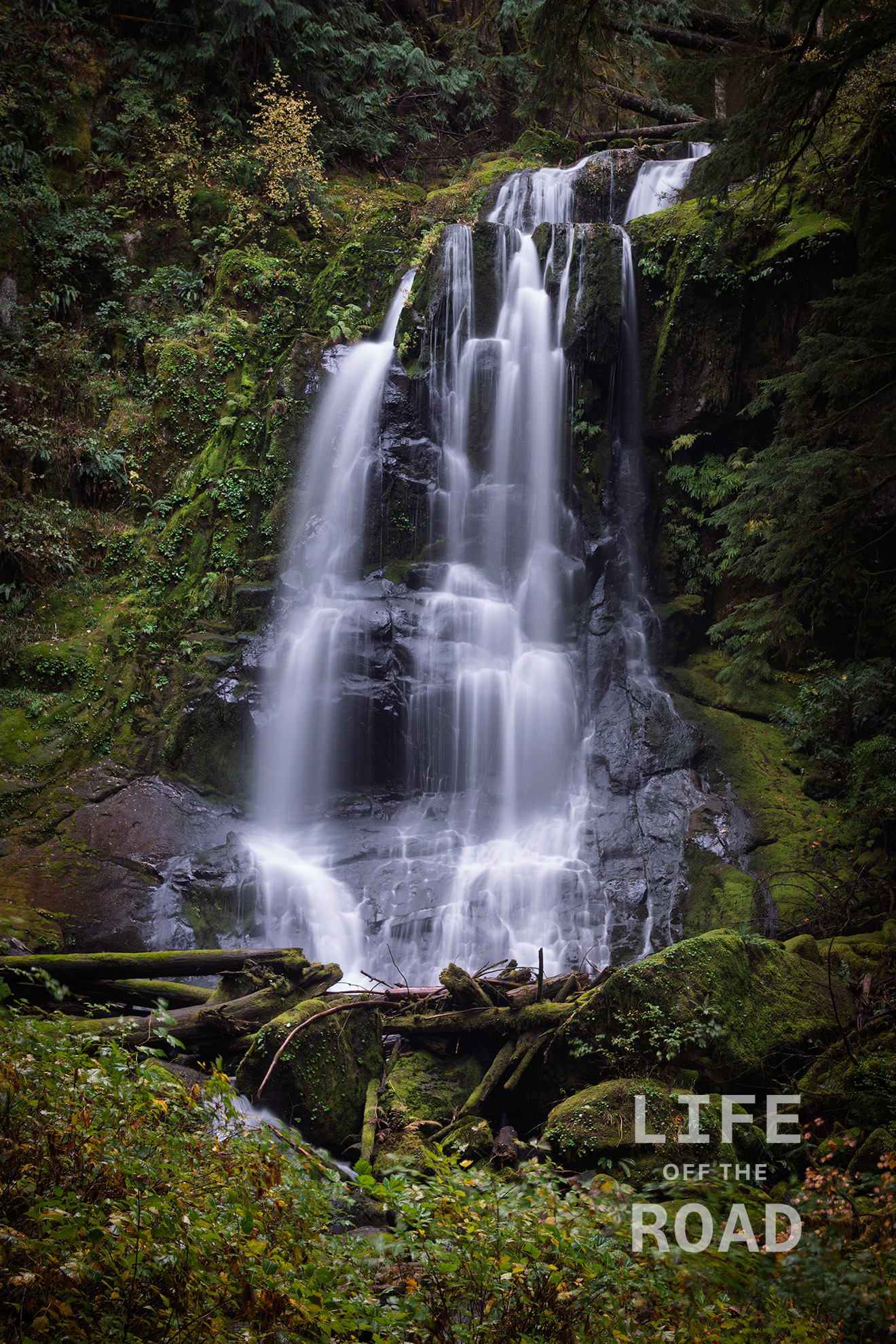
Kentucky Falls
The Siuslaw National Forest is a hodgepodge of land encompassing (according to the USFS) 630,000 acres of coastal land in Oregon, from the dunes of Coos Bay to the rain forest south of Tillamook. It is not continuous, which is unfortunate for off-road travelers like myself, but I am thankful for the large portion of Oregon’s Coast Range Mountains that it does keep open to the public. Kentucky Falls is located on Kentucky Creek which features three waterfalls in this area; the upper falls pictured here, the lower falls, and The North Fork Falls on the adjacent Smith River. I did not have time on this trip, which began near the California border, to hike all of the falls, but the upper falls is less than a mile from the trailhead so I could not pass up the opportunity to at least photograph the upper falls.
-
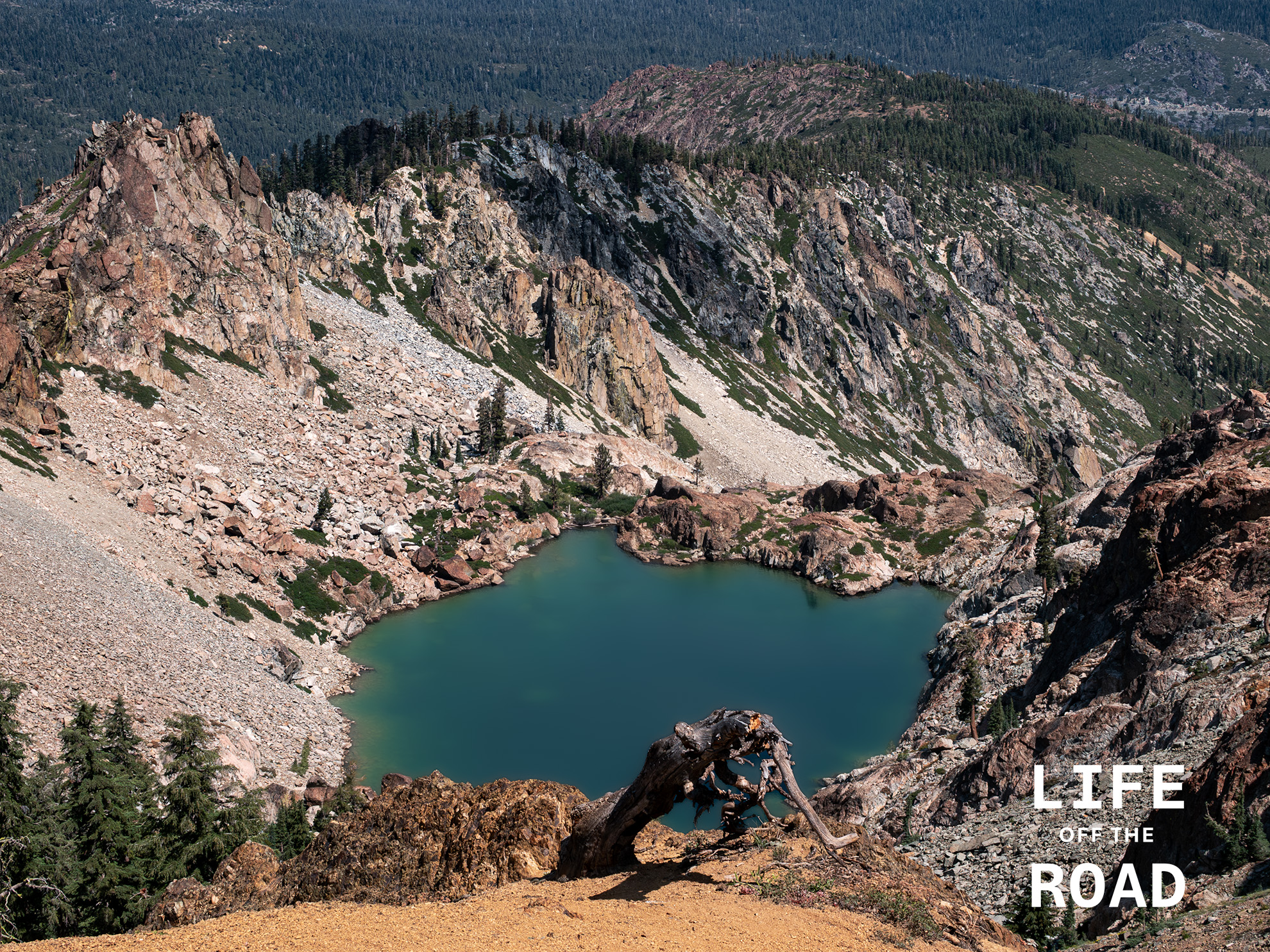
Young America Lake
Young America Lake sits high in the Sierra Buttes above Sierra City, California and is only visible from high-up in the Buttes. Likely named for the Young America Mine, which was one of Sierra County’s richest gold mines in the late 1800’s. This spot is accessible via the Sierra Buttes Lookout Trail which crosses the Pacific Crest Trail, just over the ridgeline one the left-side of the photo, or via a somewhat harrowing wagon road named Sierra Buttes Road, which climbs (rapidly) out of Sierra City. Acrophobic’s beware.
-
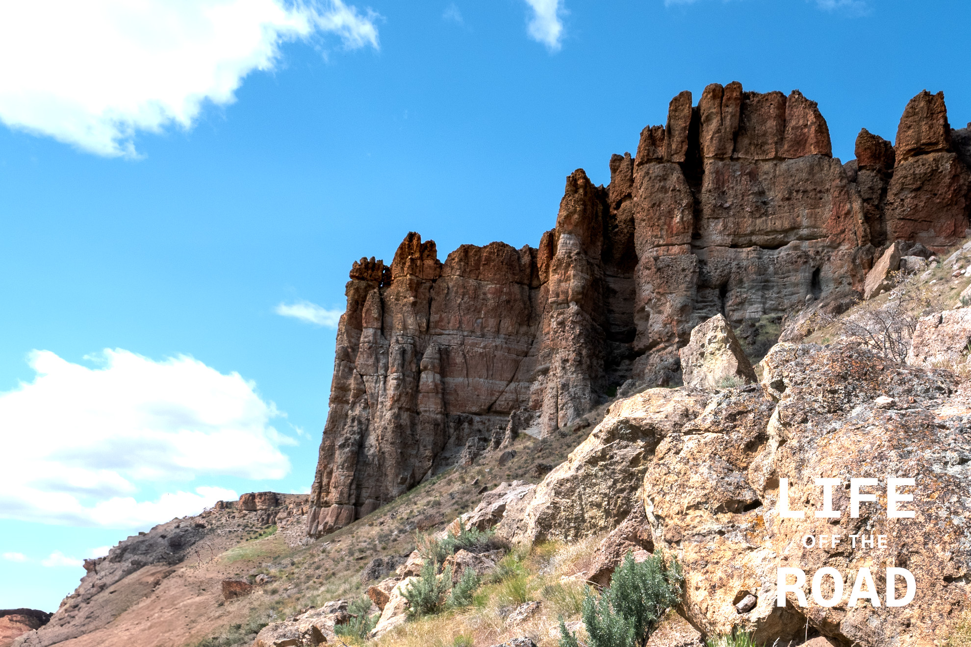
John Day National Monument – Clarno Unit
Imagine Eastern Oregon as a steamy, humid landscape filled with diverse plant life. That’s the scene the Clarno Unit’s fossils paint. The area’s unique geology, a result of volcanic activity, is the reason these fossils are so well-preserved. Massive volcanic mudflows, known as lahars, swept through the landscape, entombing plants, nuts, and even the remains of ancient mammals in their path. These events created a “snapshot” of a bygone ecosystem, capturing life in a moment of time.
Most people have heard about Oregon’s famous Painted Hills, but few venture outside that area of the John Day National Monument, to the Clarno or Sheep Rock units. The Clarno Unit is very compact, with easy trails that wind their way in and around rockfall from the tall spires of the ancient lahars, towering above. Numerous examples of the ancient flora and fauna can be seen captured in the ancient mudflows, along the trail. Numerous interpretive signs along the trails point to specific fossils features within the rock, or explain the natural conditions of the area, at the time. In this arid area of Oregon, it is difficult for us to imagine early elephants wandering about the forested savannah of what is now Eastern Oregon.
-
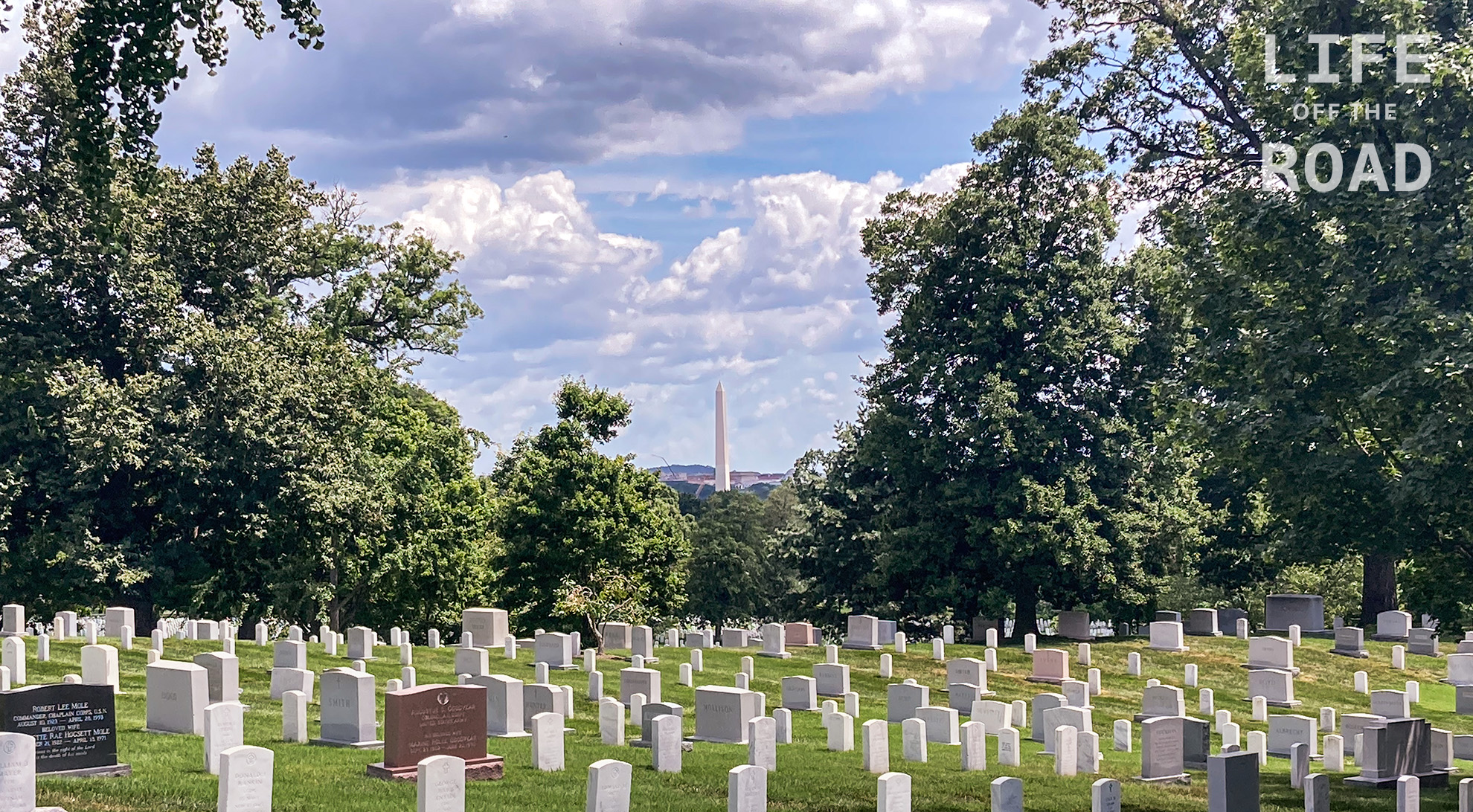
Arlington National Cemetery
Not a typical photograph that you will find here, but I spent a long weekend in Washington D.C. with a group of folks that I served in the Army with, back in the mid-1980’s to the early 1990’s. On this day we laid a wreath at the Tomb of the Unknown Soldier and, as we were leaving, I came across this view of the Washington Monument in the background.
-
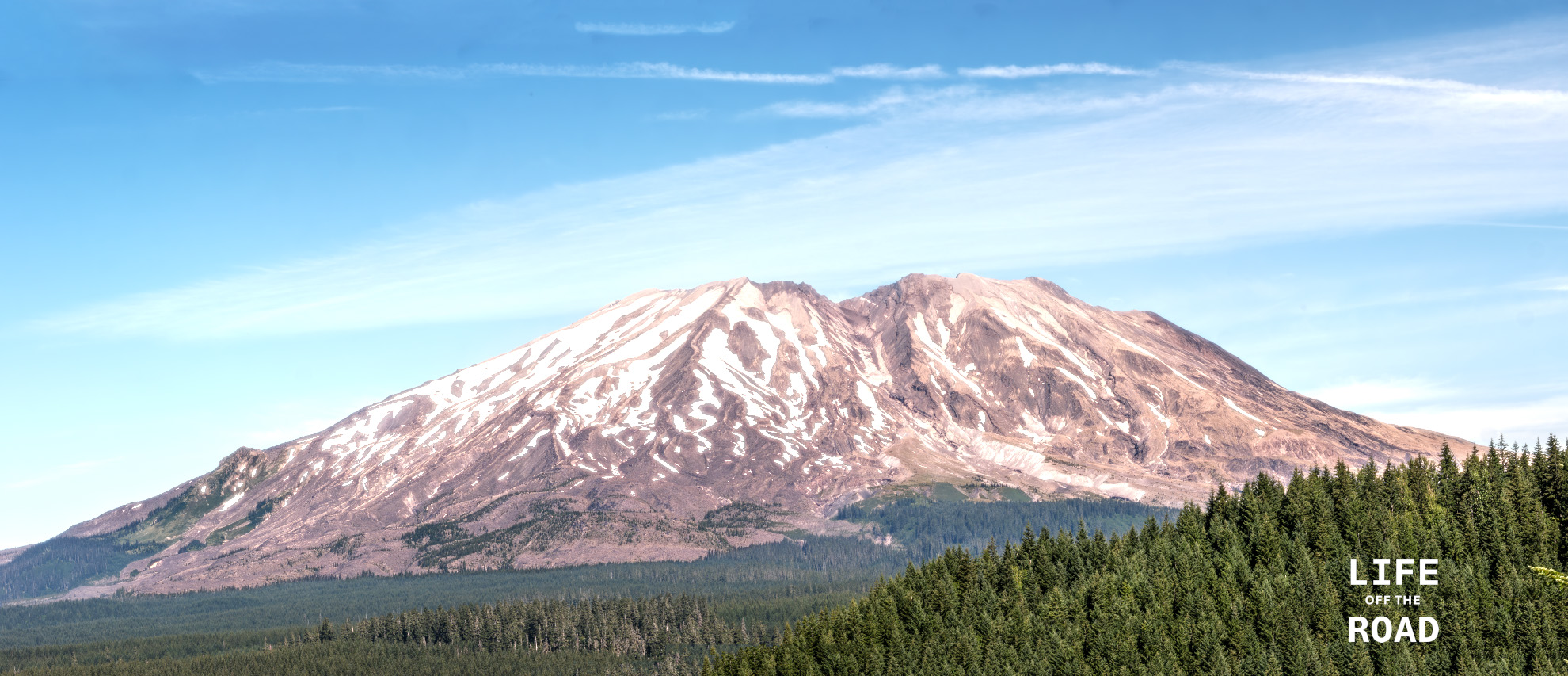
Mount St. Helens
Having lived in Oregon for much of my life, and having experienced the eruption of Mount St. Helens in 1980 (albeit as a freshman in high school!), I am a bit chagrined to admit that I have never visited the mountain. Researching places to photograph the mountain, I came across Lahar Viewpoint in the Gifford Pinchot National Forest. The viewpoint was interesting and I did get some pictures there, but the forest is returning to the area, making clear views of the mountain a challenge. Just up the road (Forest Road 83) perhaps 1/4 mile from the viewpoint is a bridge over what must have been the path of the mudflow (“lahar”) from the volcano, which is now a small stream. Fortunately, the bridge has a sidewalk, offering a safe place to setup the tripod for some of the clearest views of the south side of Mount St. Helens. This photograph is not from that spot, although I did take some good ones from the bridge! I stumbled on the location of this photograph on my way home, on a spur road off of another forest road – where I ran into a locked gate, and had to double back towards the main Forest Road 83. While doubling back, I took several side roads to see if they might get me around the locked area, but no luck. On one of those roads, however, I came upon this stunning view of the mountain. Sometimes it is better to be lucky, I guess!
-
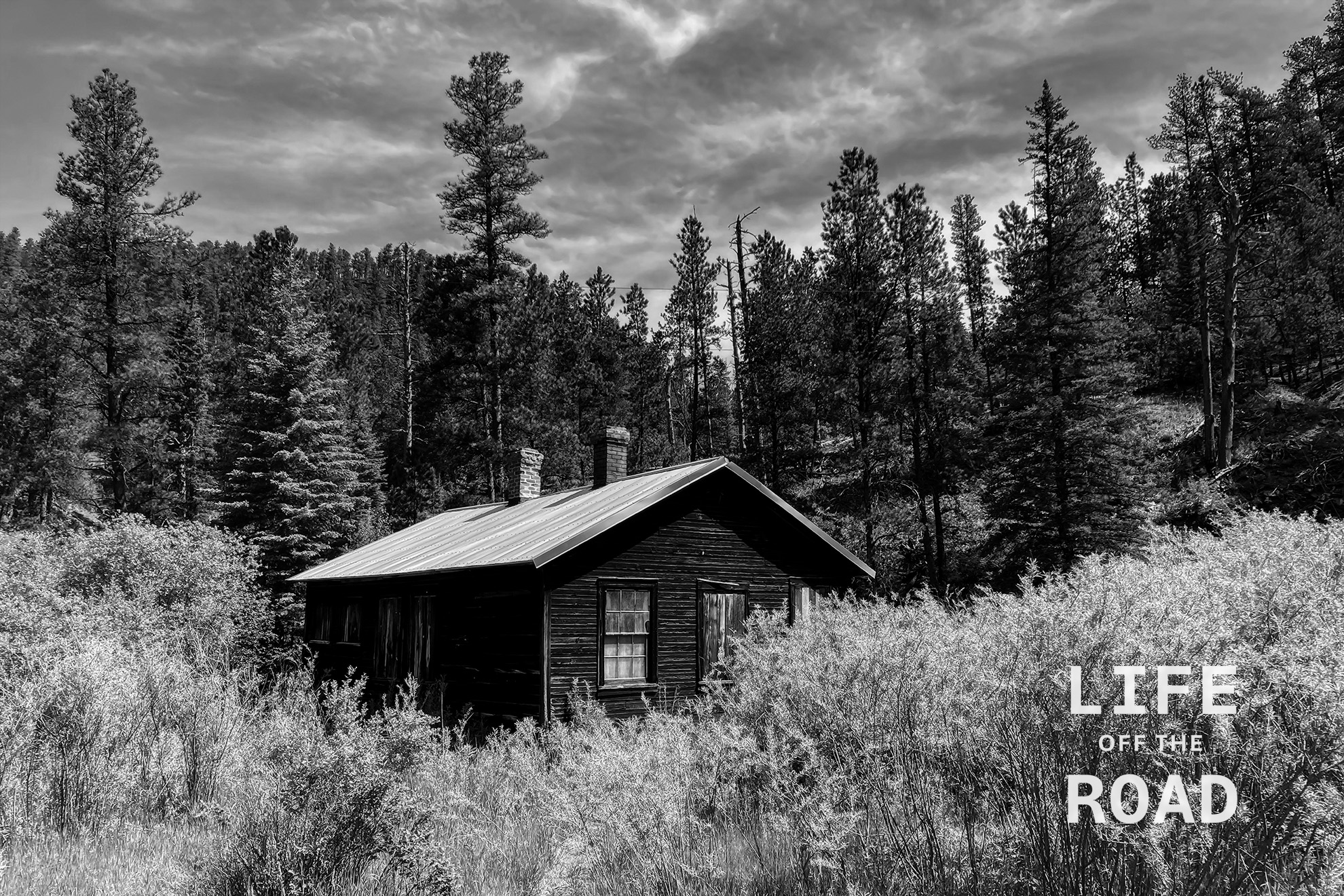
Mystic, South Dakota
Mystic is a ghost town in the Black Hills of South Dakota. Originally a gold mining encampment called Sitting Bull, in 1876, the (now) town changed its name to Mystic in 1889. After the turn of the century, Mystic became more of a lumber town than a mining town, and remnants of the old sawmill – like this building – remain in the area.