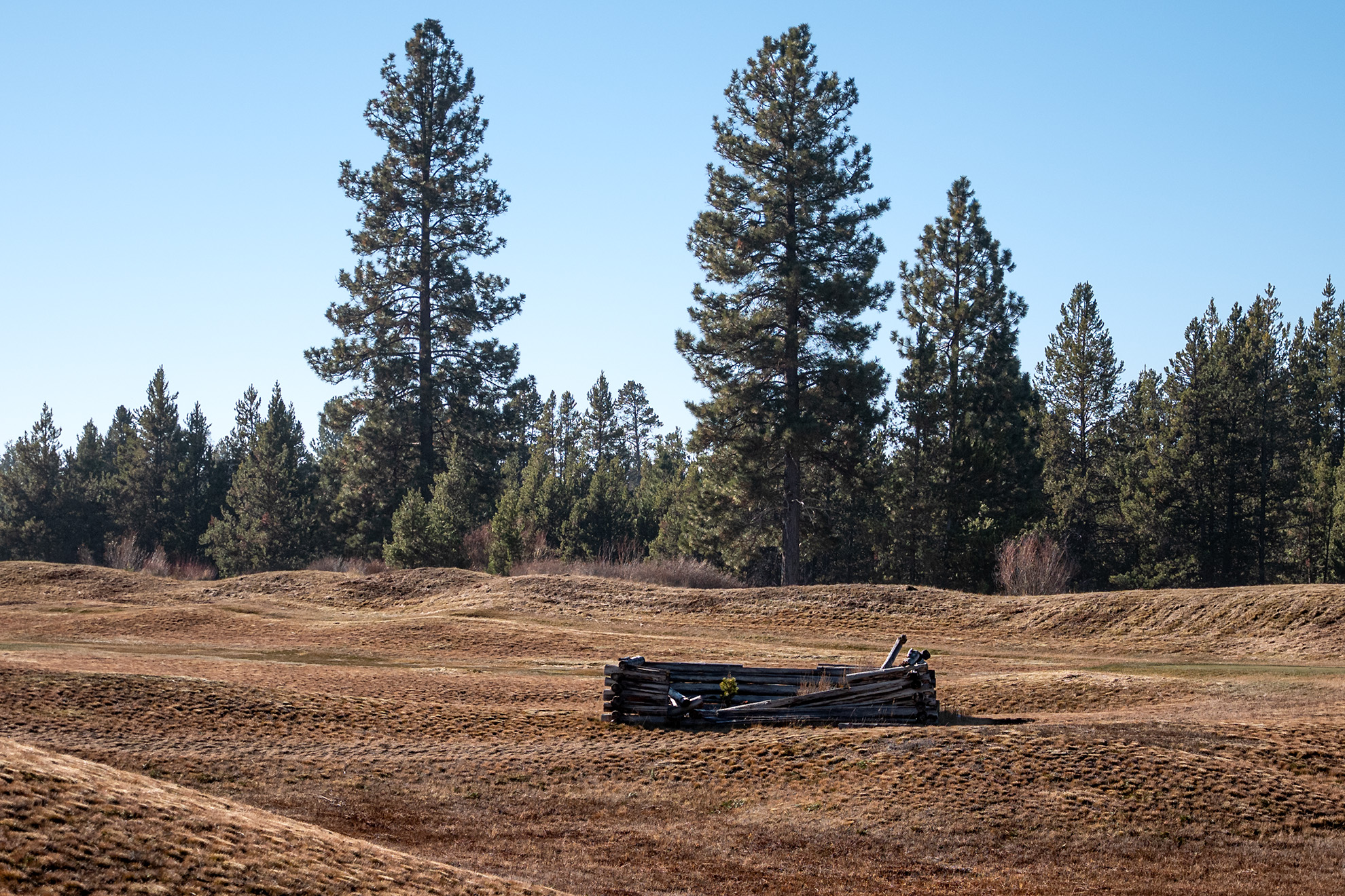
Not my normal photographic subject, but I happened to be taking a morning hike around Caldera Springs which is a resort community south of Bend, Oregon and I happened on this setting, along one of its golf course holes. Despite its modernity, I found it picturesque with the two tall pines in the background. It is a slow time of year for off-road travel with the holiday’s, but soon after the New Year I have plans to meet up with Kitt from Seattle and hopefully several other adventurers, for some desert driving in southern Nevada. Here we are in late November and it seems like just yesterday that I was picking my way through the snow drifts remaining in the Three Creek Lake area between Bend and Sisters. As we head into the Thanksgiving holiday here in the U.S. I am busy fitting additional skid plates to the underside of the jeep, in preparation for the Jeepers Jamboree in July. I am not one for crowds, but I am also not one for tackling the Rubicon Trail on my own, so I thought that this would be the easiest way to gain some experience on the fabled trail.
Category: Oregon
These are posts and images from Oregon
-
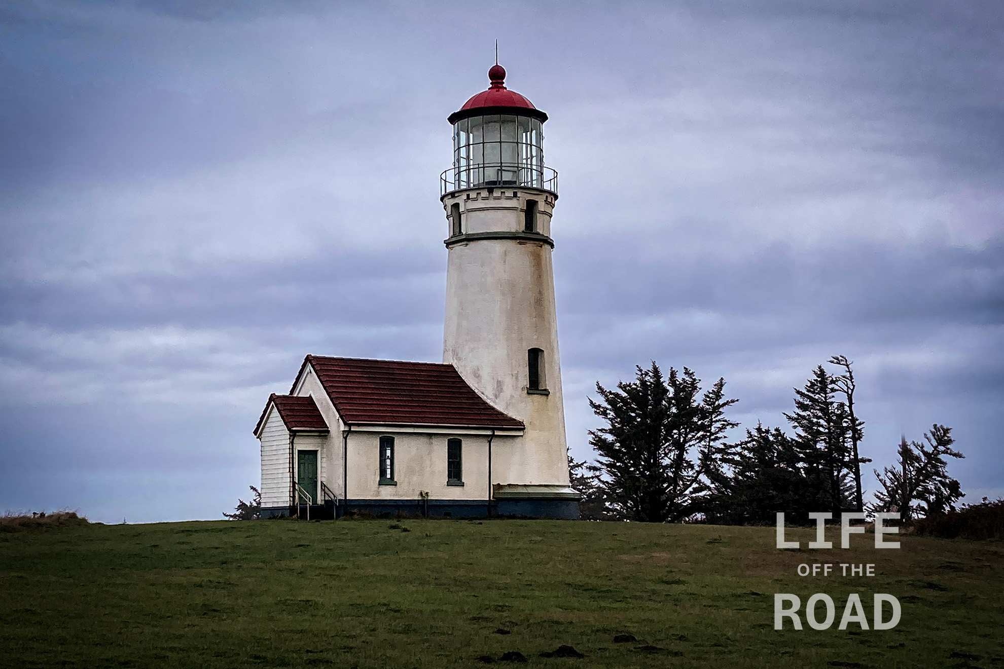
Cape Blanco Lighthouse
The lighthouse at Cape Blanco is one of the oldest continuously operating lighthouses on the west coast, signaling mariners since December 20, 1870 (Point Pinos in Pacific Grove, California went into operation on February 1, 1855). If not the oldest, it is certainly one of the highest; perched atop the 200-foot (61 meters) cliffs of Cape Blanco. The tower itself is 50-feet (15.24 meters) tall. Unlike some of the other lighthouses on the Oregon Coast, there are no public tours inside the lighthouse, but you are free to walk the grounds and there is nearby visitors center.
-
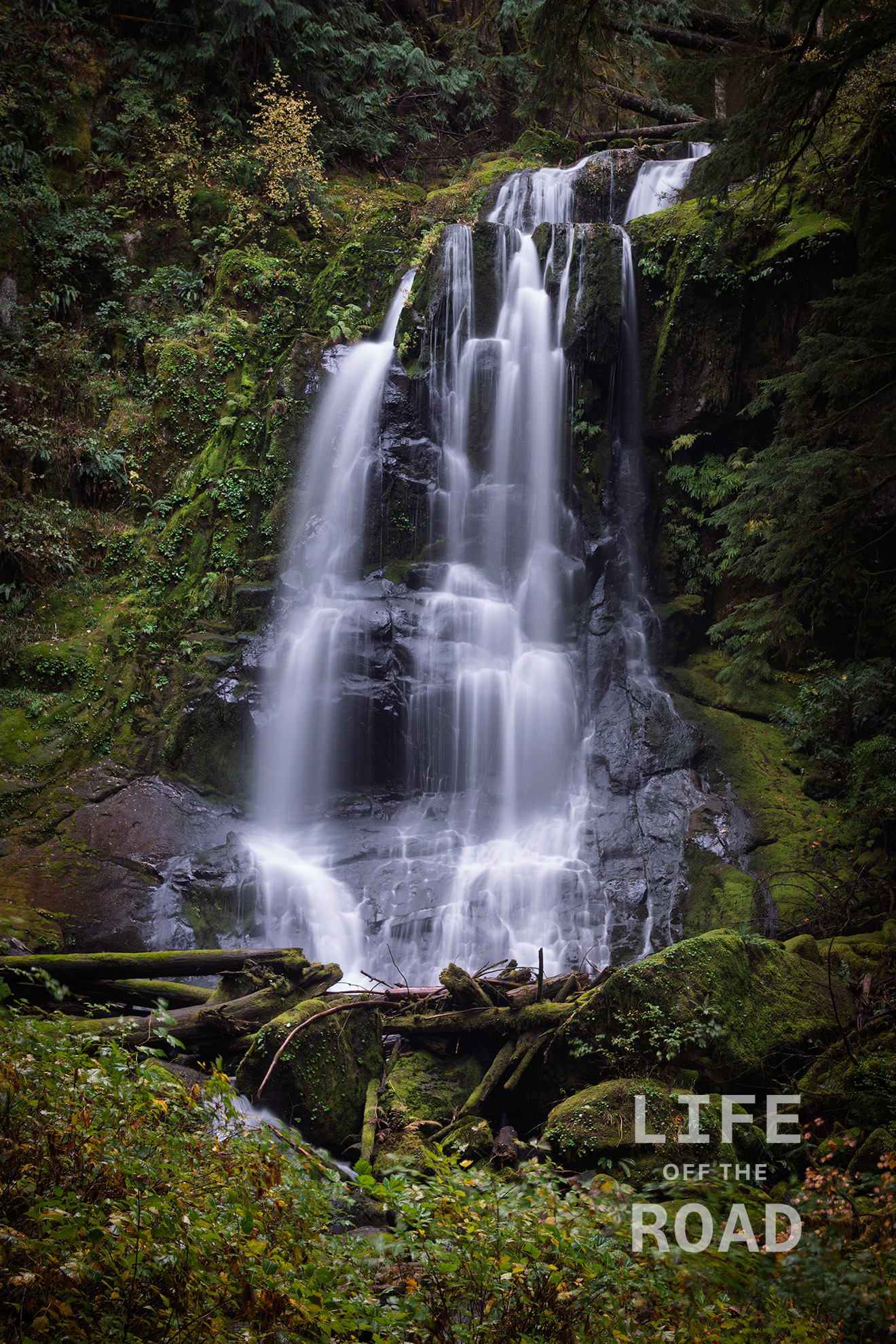
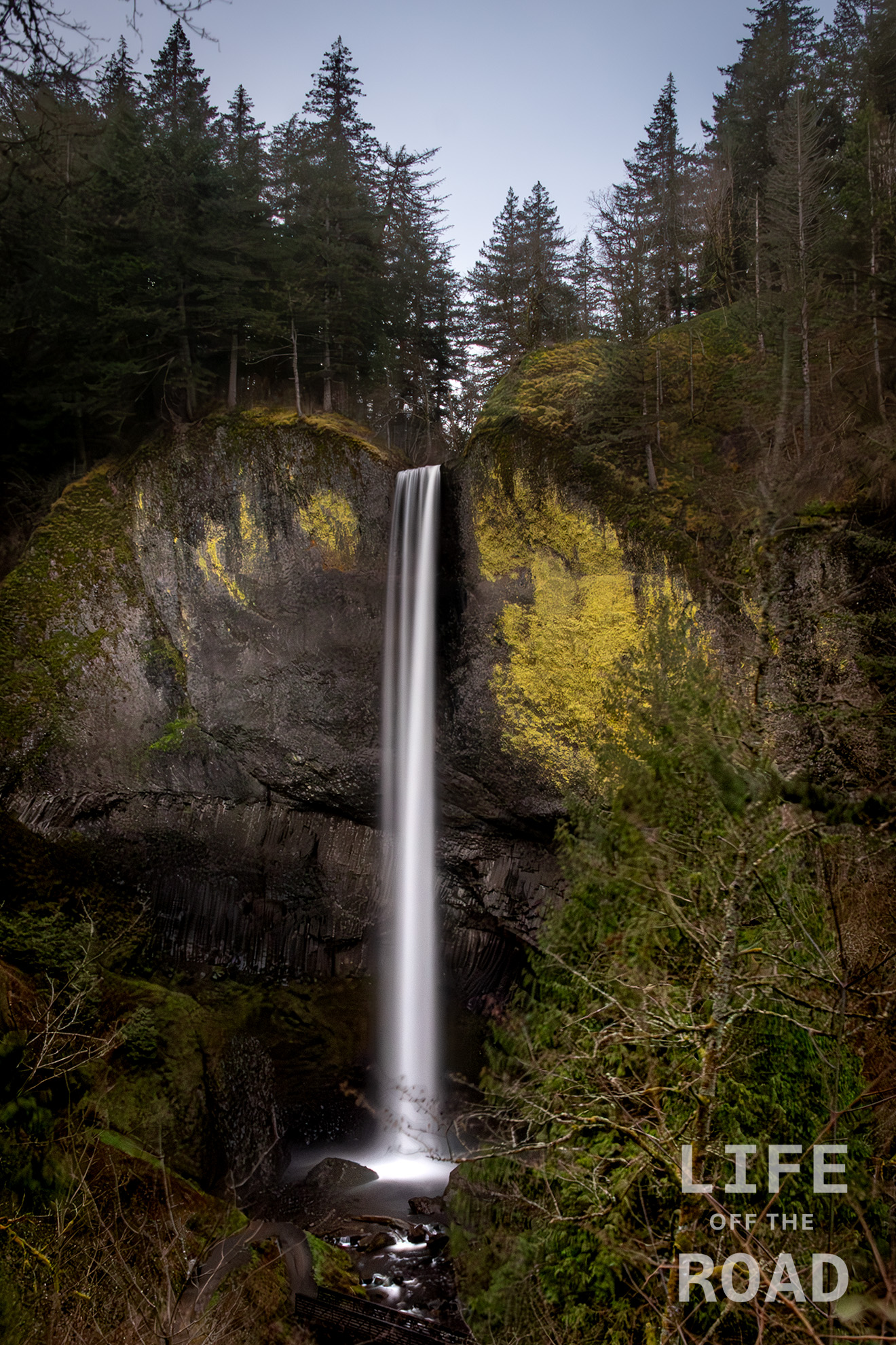
Kentucky Falls
The Siuslaw National Forest is a hodgepodge of land encompassing (according to the USFS) 630,000 acres of coastal land in Oregon, from the dunes of Coos Bay to the rain forest south of Tillamook. It is not continuous, which is unfortunate for off-road travelers like myself, but I am thankful for the large portion of Oregon’s Coast Range Mountains that it does keep open to the public. Kentucky Falls is located on Kentucky Creek which features three waterfalls in this area; the upper falls pictured here, the lower falls, and The North Fork Falls on the adjacent Smith River. I did not have time on this trip, which began near the California border, to hike all of the falls, but the upper falls is less than a mile from the trailhead so I could not pass up the opportunity to at least photograph the upper falls.
-
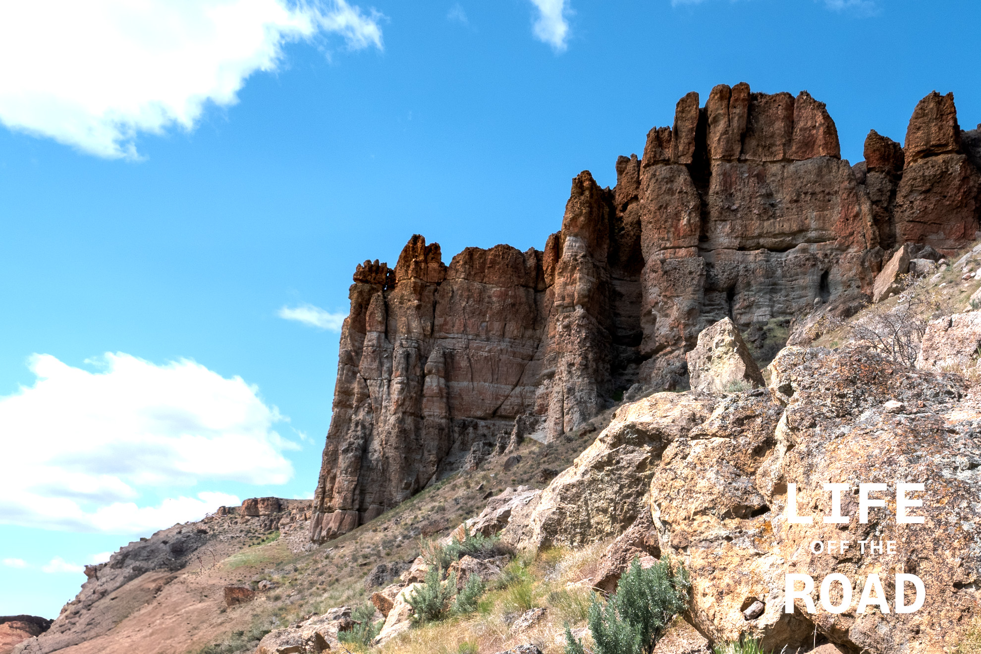
John Day National Monument – Clarno Unit
Imagine Eastern Oregon as a steamy, humid landscape filled with diverse plant life. That’s the scene the Clarno Unit’s fossils paint. The area’s unique geology, a result of volcanic activity, is the reason these fossils are so well-preserved. Massive volcanic mudflows, known as lahars, swept through the landscape, entombing plants, nuts, and even the remains of ancient mammals in their path. These events created a “snapshot” of a bygone ecosystem, capturing life in a moment of time.
Most people have heard about Oregon’s famous Painted Hills, but few venture outside that area of the John Day National Monument, to the Clarno or Sheep Rock units. The Clarno Unit is very compact, with easy trails that wind their way in and around rockfall from the tall spires of the ancient lahars, towering above. Numerous examples of the ancient flora and fauna can be seen captured in the ancient mudflows, along the trail. Numerous interpretive signs along the trails point to specific fossils features within the rock, or explain the natural conditions of the area, at the time. In this arid area of Oregon, it is difficult for us to imagine early elephants wandering about the forested savannah of what is now Eastern Oregon.
-
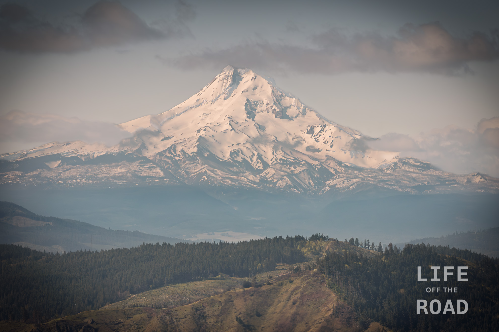
Mount Hood from Washington
Opportunities to capture a fully-snowcapped Mount Hood are winding down, as Government Camp will hit 80f / 27c today. In late April I was over on the Washington side of the Columbia River in the hills above White Salmon and captured this view of Mount Hood.
-
Firebreak 5 Jeep Badge of Honor Trail
Last month during a rare break in the rain, I travelled over to the Tillamook State Forest and ran one of Jeep’s “Badge of Honor” trails, called Cedar Tree. With the rain mostly behind us, here in Oregon, I headed back over to the Tillamook State Forest on a Friday afternoon to run the second of the two Jeep BoH trails there, called “Firebreak 5.” Once our weather begins turning warmer and dryer, Tillamook State Forest becomes a bit crowded on the weekends, thus my Friday excursion and I was the only one on the trail. I imagine that Firebreak 5 might be a zoo on the weekends, as it can be run from both directions and there are very few spots to get off the trail in order to let others by. I had no idea which direction to run the trail, but picked south-to-north because Cedar Tree is “generally” a north-to-south trail, and that puts you right at the beginning of Firebreak 5.

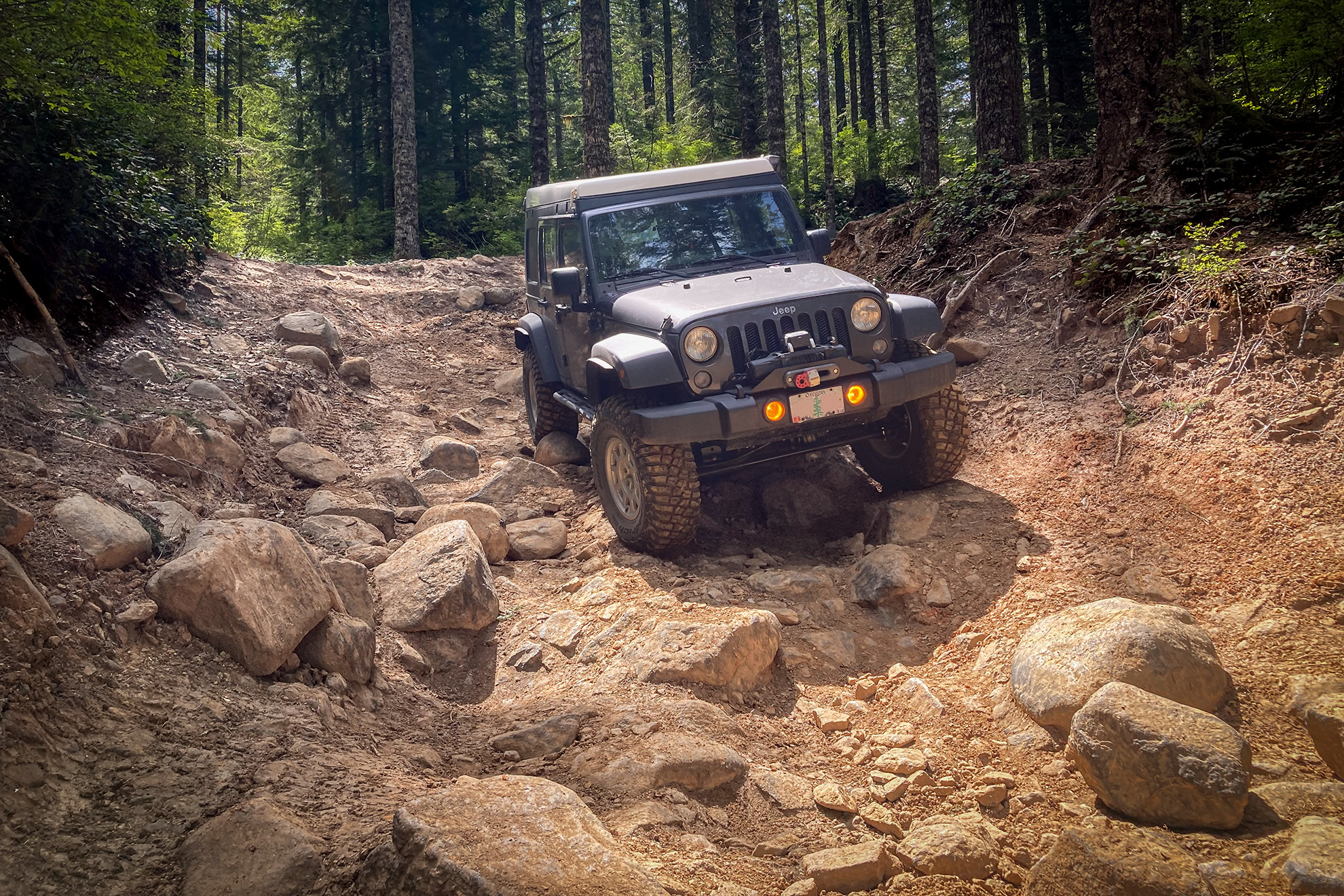
There are several pinch sections on Firebreak 5 that will challenge full-size vehicles Spoiler alert: South-to-north on Firebreak 5 is all downhill, making the trail much easier than north-to-south. Easier does not mean “Cedar Tree” easy. Jeep rates Firebreak 5 a 5-7 vs. a 4 for Cedar Tree. In my opinion, Cedar Tree is a 3 and Firebreak 5 is a 4, perhaps a 4-5 if run north-to-south. It is a great trail for practicing rock crawling, though. Like Caine finally taking the pebble from Master Kan’s hand, when one can run Firebreak 5 without smacking the rear differential on a rock (I did not pass the test on this trip), one has achieved rock crawling zen. It is not that the rocks are huge, and there are not any stair step ledges, but everything is loose and your tires are prone to “kick out” and drop your rear differential onto a nascent boulder.

This view “down the chute” shows how Firebreak 5 is much easier when run south-to-north, which is all downhill By my calculations on Gaia GPS, Firebreak 5 is a little over 2.4 miles long so about a half-mile shorter than Cedar Tree. Like Cedar Tree where you can add University Firepower onto the frontend of the trail for some additional distance, there is also Saddle Up that comes into Firebreak 5 from the south. Gaia or a similar mapping system is a must in order to work your way through the myriad of logging roads in the Tillamook State Forest, though once you are on the trails, they are well marked and easy to follow. Note that there is no wireless coverage in the area.

The last rocky chute on Firebreak 5 before exiting onto Beaver Dam Road Like Cedar Tree, Firebreak 5 made for a quick afternoon escape into the woods. Going during the week was definitely a plus, as there was no traffic on the trail. When I did Cedar Tree on a Saturday morning, there were half-a-dozen other Jeeps and motorcycles on the trail – and that was during the wet season in March. If you have ever wanted to test your metal on some real rocks, Firebreak 5 is a great trail to begin honing your rock crawling skills.
-

Oregon’s Painted Hills
Travel Oregon has a list of seven natural wonders in Oregon, and the Painted Hills unit of the John Day Fossil Beds National Monument is one of them. The others are Crater Lake, the Columbia River Gorge, Mount Hood, Smith Rock State Park, the Wallowa Mountains, and the Oregon Coast. I am a bit chagrined to admit that I have not been to the Painted Hills, or any of the other areas that comprise the John Day Fossil Beds National Monument, so I decided to remedy that with a day trip.

The three units of the John Day Fossil Beds National Monument The John Day Fossil Beds NM is actually three separate locations, with the Painted Hills unit being the popular one that the majority of people visit. In addition, there is the Clarno Unit forty-five miles to the north, and the Sheep Rock unit, forty-five miles to the east. The Painted Hills unit is two hundred miles from Portland, making this a challenging day trip!
I arrived at the Painted Hills in the morning and headed up the Carroll Rim Trail which gains about two hundred feet, providing one of the best views of the Painted Hills area. There are numerous other trails that branch out along the base of the hills, for equally impressive close-up views.
I did not have enough time to include the Sheep Rock unit on this trip, but I did visit the Clarno unit on the way home. Unlike the smooth multi-colored hills, the Clarno unit is an ancient volcanic mudflow that has eroded away into tall spires. It reminded me of the Needles District in Canyonlands National Park. Since this was a mudflow, though, there are the fossilized remains of plant material in nearly every rock. For my untrained eyes, the fossils were not always easy to see. The rocks formed by the 45-million-year-old mud are weathered and covered with lichens, camouflaging the fossilized leaves. Fortunately, the park has numerous signage along the trails, pointing-out specific fossils.
-

April Tulips in Oregon
It’s the most wonderful time of the year! The daffodils have mostly come and gone by the first of April, but now the tulips are blooming, telling us the spring really is here, after a number of false starts in March.
-
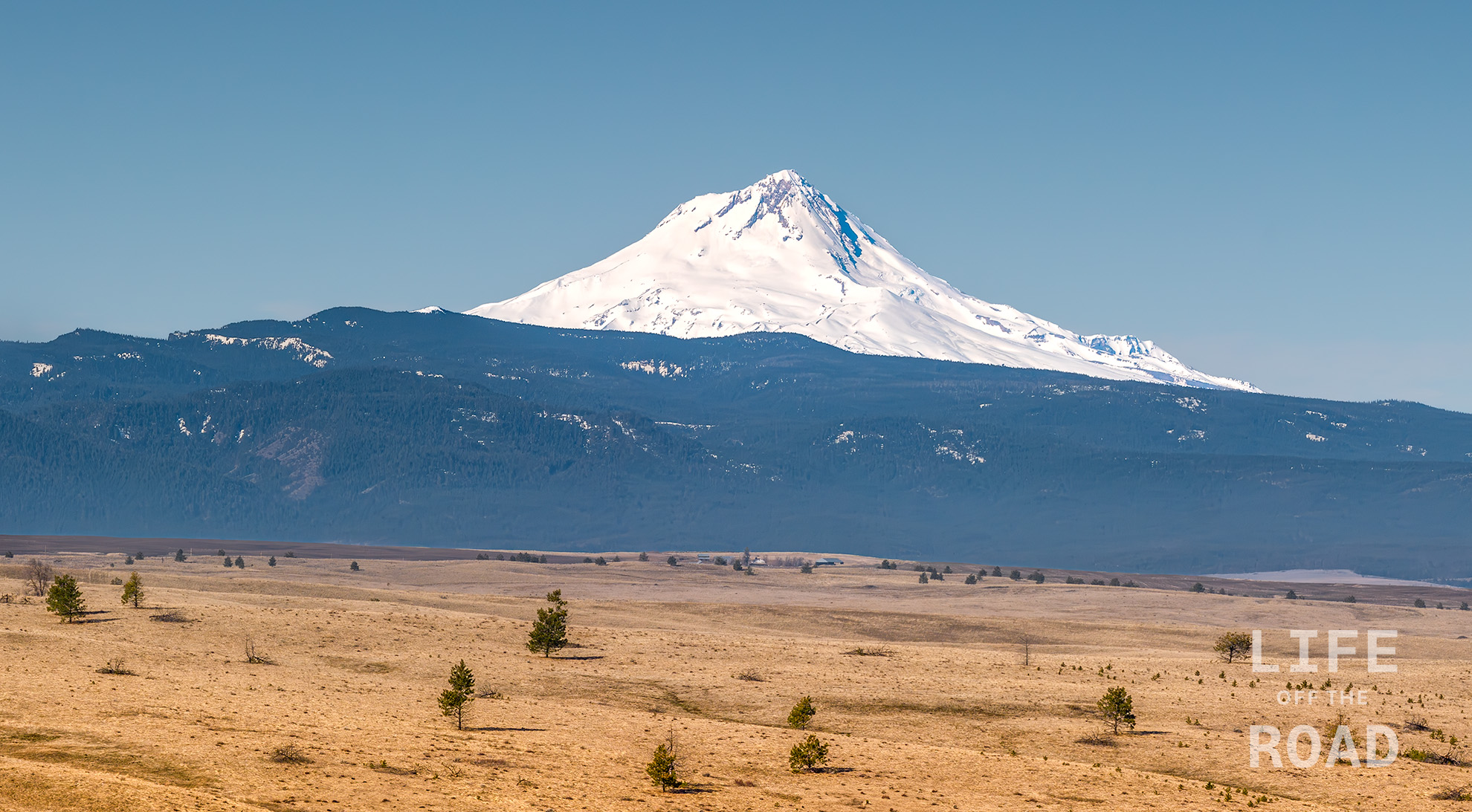
Mount Hood
Mount Hood is Oregon’s highest mountain, at 11,249 feet, and one of three active volcanoes around the Columbia Gorge; Mount St. Helens last erupted in 1980, Mount Hood in the 1790’s, and Mount Adams around 1000. These mountains are part of the Cascade Volcanic Arc, stretching from British Columbia to Northern California. This arc also forms a demarcation between the Pacific Ocean-facing western side with its lush rainforests, and the arid eastern side shown here, with less than 20-inches of annual rainfall.
-
Cedar Tree Jeep Badge of Honor Trail
Jeep runs a fun program called the Jeep Badge of Honor Trail program that identifies a number of off-road trails around the country as “official” BoH trails for Jeeps, and uses a phone app that allows users to “check-in” to these trails and get credit for driving them. Jeep will also send you a nice-looking badge with the trail’s name, that you can stick onto the side of your Jeep, if you are into that sort of thing. As a Jeep owner I had heard of the BoH thing but never paid much attention to it, until my trip across Utah with Dan, Mike and Adam. They wanted to spend a few days in Moab which is Jeep BoH Mecca, and get credit for a number of trails, there. We knocked-out four of the BoH trails while we were there, and several months later I received the little badges from Jeep, and I was hooked! Yes, I am easily amused.

They are not always this fast, but one week later my badge arrived via UPS Fast-forward six months and in true Portland, Oregon fashion it has been raining for several weeks. Non-stop. Today, March 22nd however, I awoke to dry weather which gave me the itch to get my Jeep out and flex its new suspension and tires. Moab had convinced me that my Jeep needed to just a little bit taller, and the tires needed to be just a little bit bigger. That was my winter project. With a dry day in front of me, I decided that it would be a great opportunity to go run one of Oregon’s Jeep BoH trails, so I headed west towards the cheese town of Tillamook.
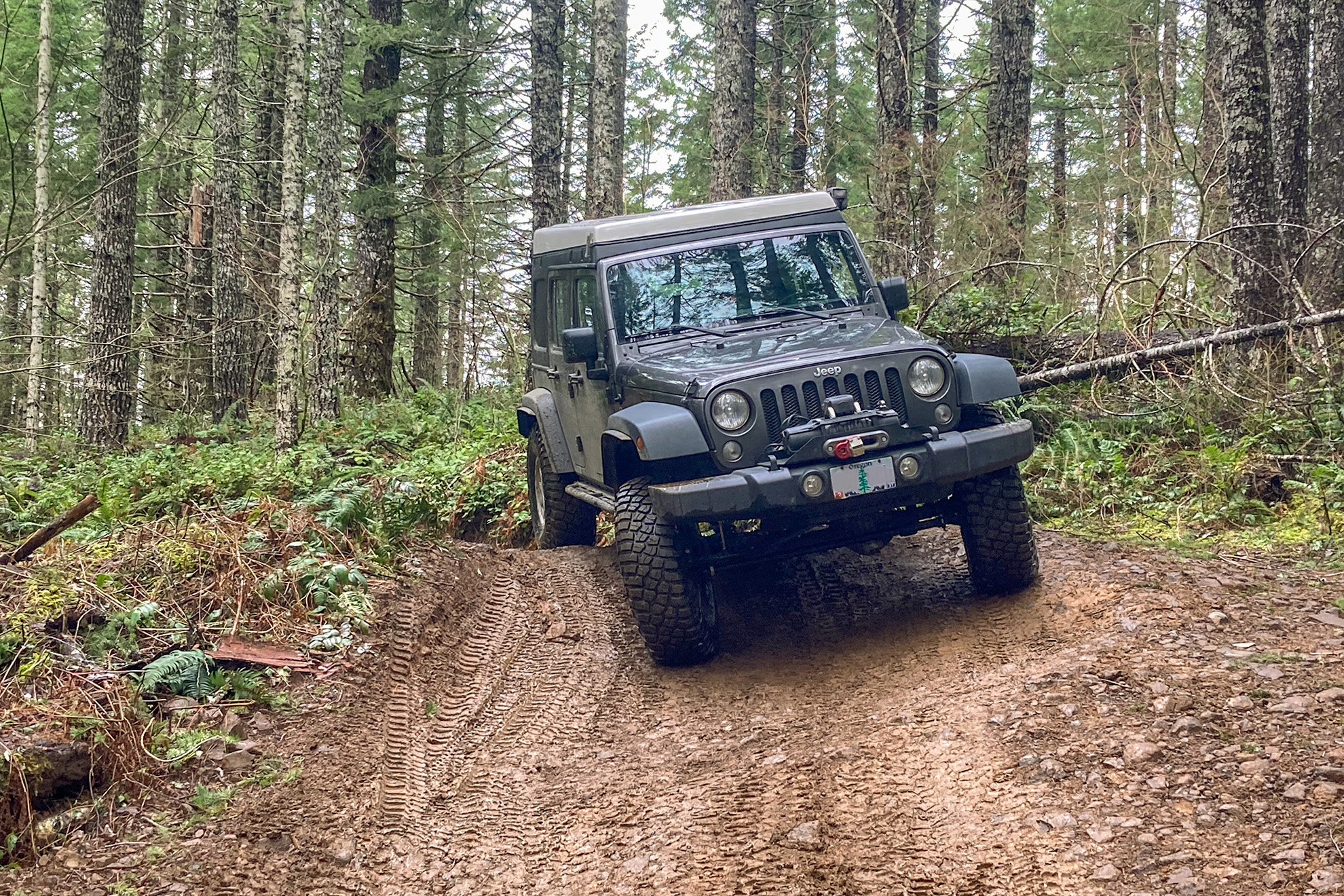
At some point on Highway 6 in the Oregon Coast Range Mountains there is a rather nondescript turnoff called Roger’s Camp Road. Fortunately, there is also a large state DOT gravel storage area at this point, making the road easier to spot. From here, you will need a good offline mapping application, as there is no mobile service in this area of the coast range, in order to find the trailhead, which in my case was called Cedar Tree. The road forks right becoming University Falls Road, and left becoming Beaver Dam Road.

University Falls is a short out-and-back hike Either road will work, although I took Beaver Dam Road and then turned south onto the University Firepower trail which connects to Cedar Tree. University Firepower also connects to University Falls Road, so that right-fork would have also worked. The University Firepower trail has a tougher rating than Cedar Tree, and I can attest that even the short segment that I did, was a lot of fun. Particularly since it had been raining for several weeks. The trail was very steep and tight, with several very sharp turns, but even without engaging the lockers (because of the sharp turns), the new mud tires performed great.

Typical of the lower portion of Cedar Tree, although there are some squeeze-points between trees After a mile of the University Firepower trail, it crosses a regular graveled logging road and the Cedar Tree trail begins. This trail is still tight with numerous trees, stumps, and roots crowding the trail, but there are no three-point turns like University Firepower. It is a fun and relaxing drive through coastal cedars and firs, and nothing that any capable four-wheel drive would have trouble, with. The Jeep BoH app rates Cedar Tree a 4 (with 1 being easiest and 10 being hardest). I would rate it a 3 or perhaps a 3-4.

Fallen cedar tree stump in the background Towards the end of the trail, it pops-out onto a clear-cut landing where the infamous fallen cedar tree stump is located. Evidently one used to be able to drive under this tree, but the wet coastal mountains reclaim all the things, and the cedar tree is no exception. The trail ends near another Jeep BoH trail called Firebreak 5 and I will be back to run that one, someday.
-
Lower Latourell Falls
Lower Latourell Falls is a 224-foot waterfall along the Historic Columbia River Highway, east of Vista House at Crown Point. Just after this photo was taken on March 9th, 2025 a section of the highway leading to Vista House was closed due to unstable conditions, leaving Latourell Falls only accessible from the Ainsworth State Park exit on Highway 84 near Cascade Locks, some twenty miles east of the falls. Though not nearly as popular as the 620-foot Multnomah Falls, which is much more easily accessible from Highway 84, both the Lower and Upper Latourell Falls are every bit as photogenic. The lower falls is the taller of the two, with its 224-foot plunge.
-
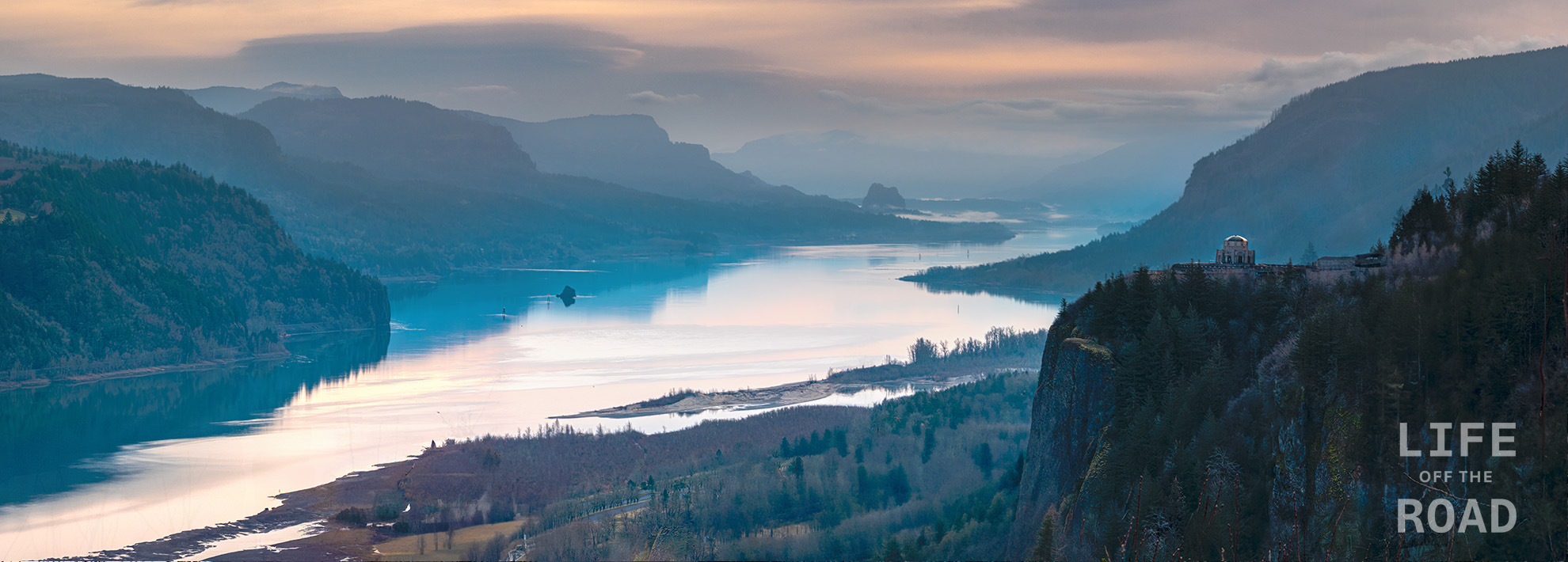
Columbia Gorge
The Columbia Gorge is one of the most geologically impressive features in North America, forming a deep path through the Cascade Mountains for the Columbia River – the largest river flowing into the Pacific Ocean from North America. The river was not always where it is today, having been pushed north by lava flows on the Oregon side, and more recently, pushed back south and even blocked, by enormous landslides from the Washington side. The layers of lava flows, reminiscent of frosted layers in a cake, form the steep cliffs on the Oregon side of the gorge providing a waterfall-rich environment between Troutdale, at the western mouth of the gorge just east of Portland, and Hood River. From the Portland Women’s Forum scenic viewpoint where this photo was taken, easily-accessible waterfalls along the Historic Columbia River Highway include Latourell Falls, Shepperd’s Dell Falls, Bridal Veil Falls, Wahkeena Falls, Multnomah Falls, and Horsetail Falls.