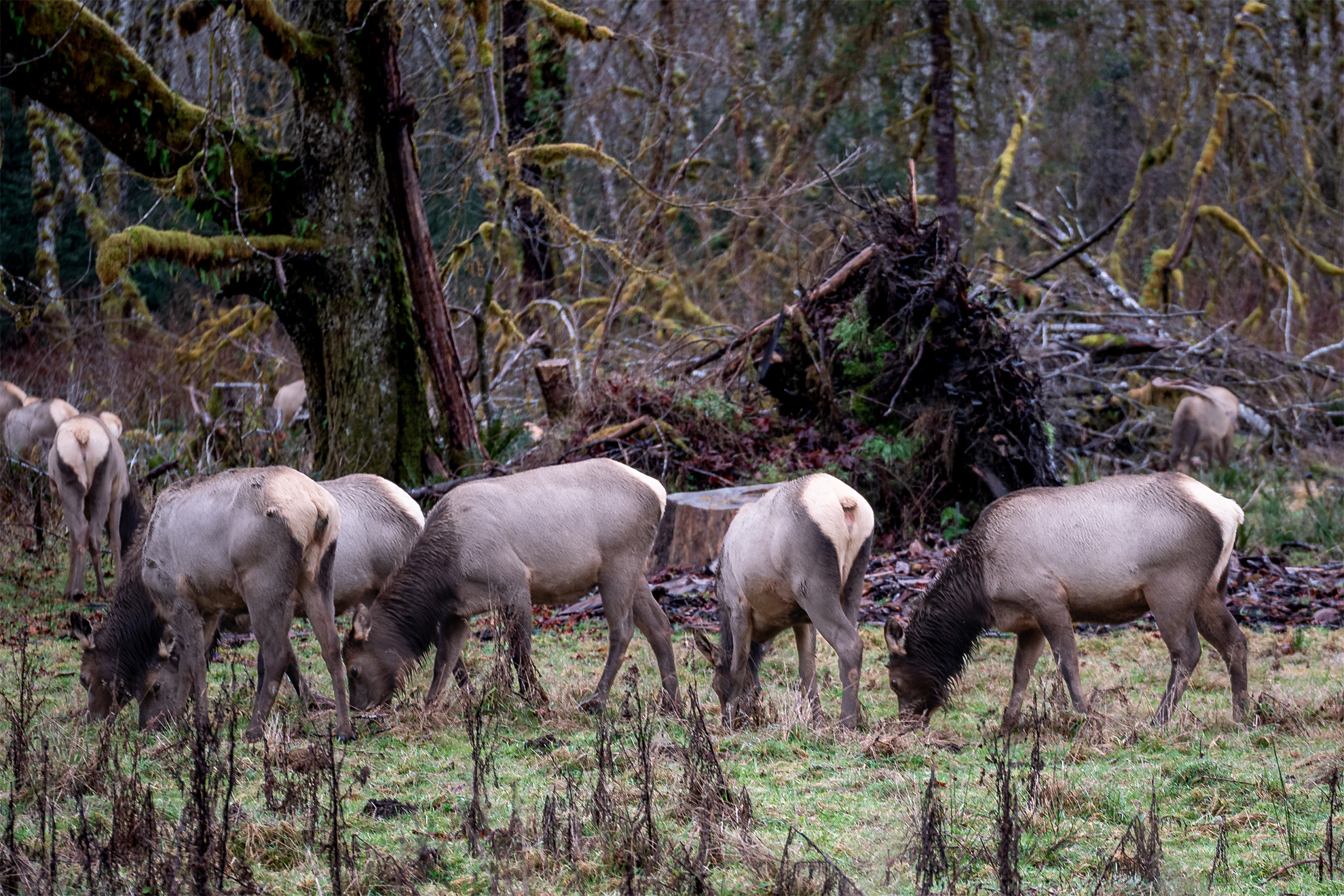
An elk herd along the Hoh River in Washington’s Olympic National Park
Category: Washington
These are posts and images from Washington
-
South of Mount Saint Helens
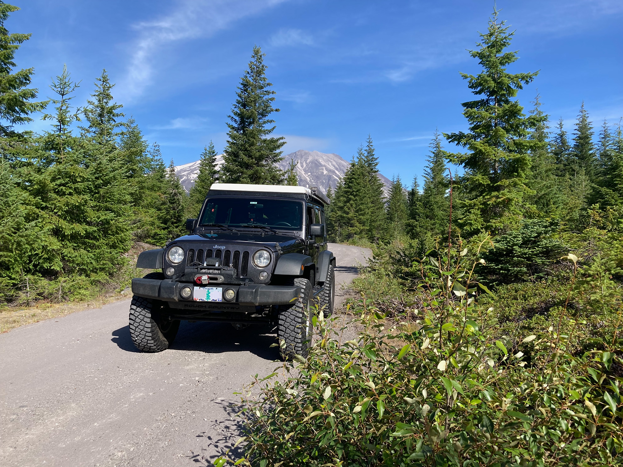
This was on a forest road south of Mount Saint Helens in July of 2025. I was attempting to get back down through the Gifford Pinchot National Forest to Stevenson or Carson but alas, I ran into a locked gate. It was not a complete loss, however, as I found some of the best views of the mountain from a small spur road. As winter sets in here in the Pacific Northwest, trips like this become very difficult as roads such as this one close for the season. Soon I will be off to southern Nevada for another trip with some friends, though.
-
Mount St. Helens
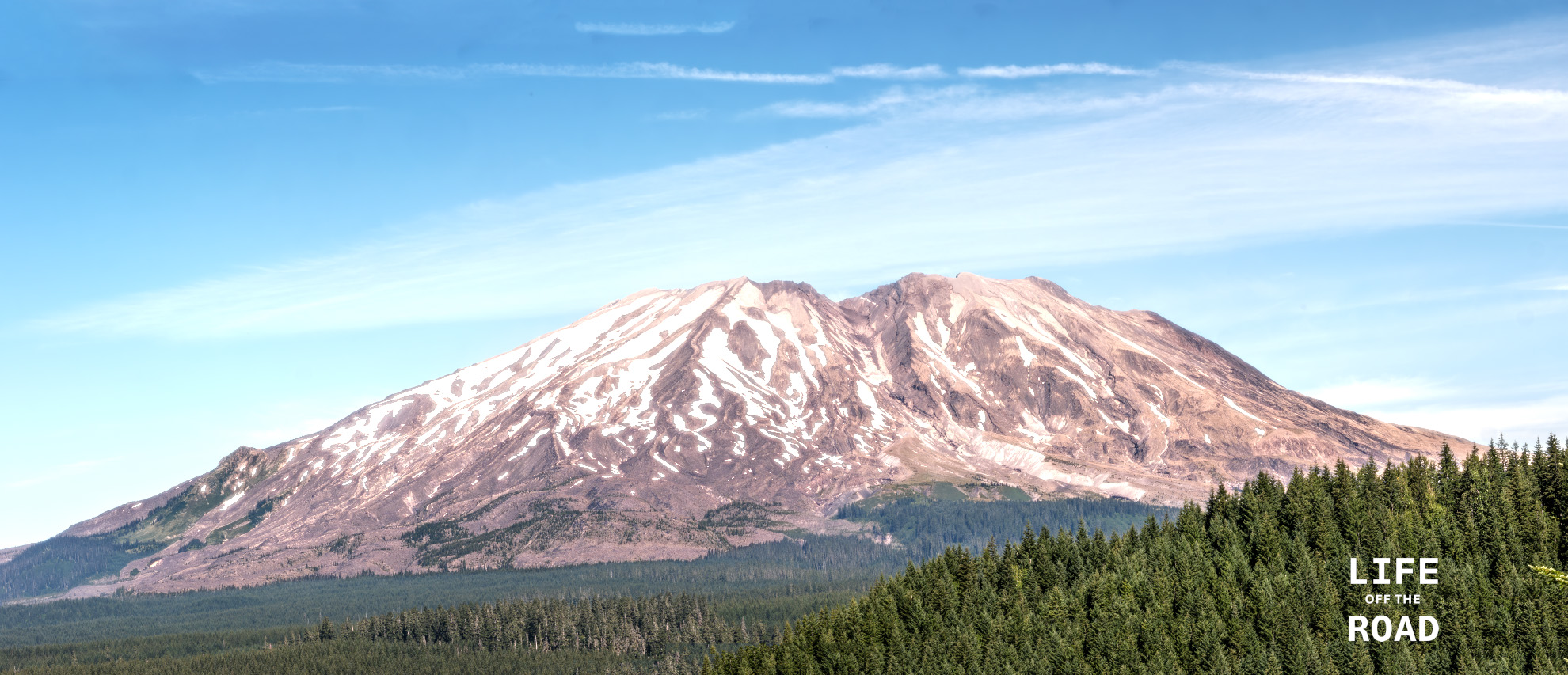
Having lived in Oregon for much of my life, and having experienced the eruption of Mount St. Helens in 1980 (albeit as a freshman in high school!), I am a bit chagrined to admit that I have never visited the mountain. Researching places to photograph the mountain, I came across Lahar Viewpoint in the Gifford Pinchot National Forest. The viewpoint was interesting and I did get some pictures there, but the forest is returning to the area, making clear views of the mountain a challenge. Just up the road (Forest Road 83) perhaps 1/4 mile from the viewpoint is a bridge over what must have been the path of the mudflow (“lahar”) from the volcano, which is now a small stream. Fortunately, the bridge has a sidewalk, offering a safe place to setup the tripod for some of the clearest views of the south side of Mount St. Helens. This photograph is not from that spot, although I did take some good ones from the bridge! I stumbled on the location of this photograph on my way home, on a spur road off of another forest road – where I ran into a locked gate, and had to double back towards the main Forest Road 83. While doubling back, I took several side roads to see if they might get me around the locked area, but no luck. On one of those roads, however, I came upon this stunning view of the mountain. Sometimes it is better to be lucky, I guess!
-
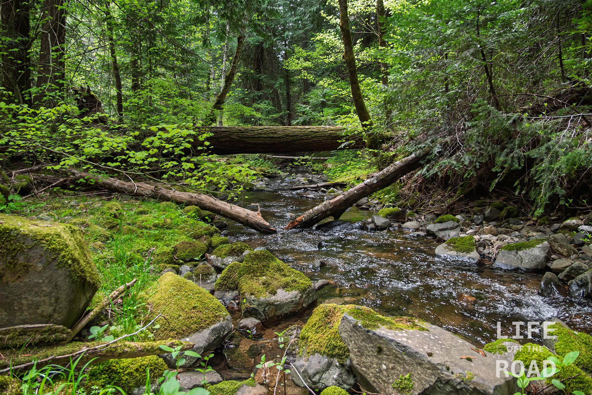
The Giants of Lost Creek
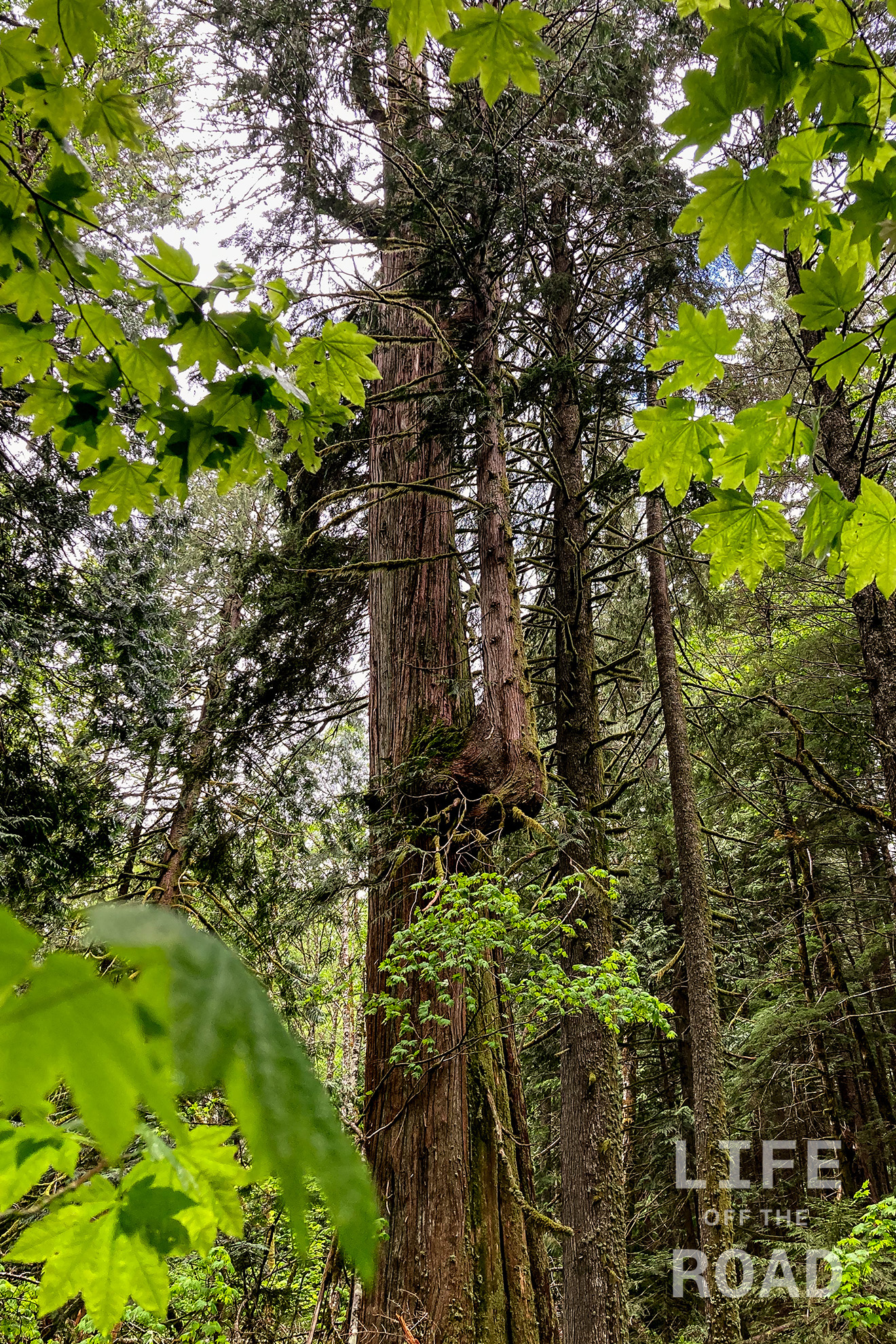
I recently stumbled on a 2015 newspaper article about a 170-acre section of old-growth timber semi-secured away along a tiny, secondary tributary in the Gifford Pinchot National Forest, called Lost Creek. There is old-growth timber in at least several places, in Gifford Pinchot. This past winter I hiked the Lewis River Trail which had a plethora of old-growth fir and cedar along the route, including a monster Douglas Fir between the middle and upper falls that rivaled the ones I could find on this trip. Old growth timber is fairly rare in northwest Oregon due to logging (of course) and forest fires, like the Tillamook Burn. These trees do not grow forever, though, and there is a massive fir tree along Lost Creek that is dead, with huge carvings of bark falling off around the tree, onto the ground. This area, like many along the creek with leaning trees propped-up by others, are somewhat dangerous and should be respected.

The forest floor along Lost Creek in the Gifford Pinchot National Forest Unlike Lewis River, Cedar Flats, or several other well-publicized locations of old-growth trees, the stand along Lost Creek has a much more remote and primitive feeling. It is still the Pacific Northwest with all of its moss and decay, but there is a “lost in time” feeling when traveling through the area, which I do not think was just my imagination. It is part of the fascination with this area, and not one that I felt while hiking along the Lewis River – even though some of the trees were just as spectacular. This area along Lost Creek is old and untouched, and you can feel it.

My pathetic attempt at demonstrating the width of a Douglas Fir along Lost Creek. My arm span is 6′ 4″ / 193cm, but of course I did not get centered on the tree! This is why I am an amateur… This was my second outing to Lost Creek, the first time being on the south-side of the creek. To be honest, I am probably going to go back, just because it is such an untouched and remote place. Ironically, the Washington Backcountry Discovery Route runs right by it, but there is nothing to make you think there might be something more lurking off in the woods. Perhaps you might see a Toyota Prius parked there, on this fairly pot-holed and rough logging road. There was one parked there, last Sunday.
-
Lusk Creek
I had spent the day exploring some areas in the Gifford Pinchot National Forest and was returning home on Forest Road 86, which runs along Lusk Creek, when this fairytale view stopped me in my tracks.
-
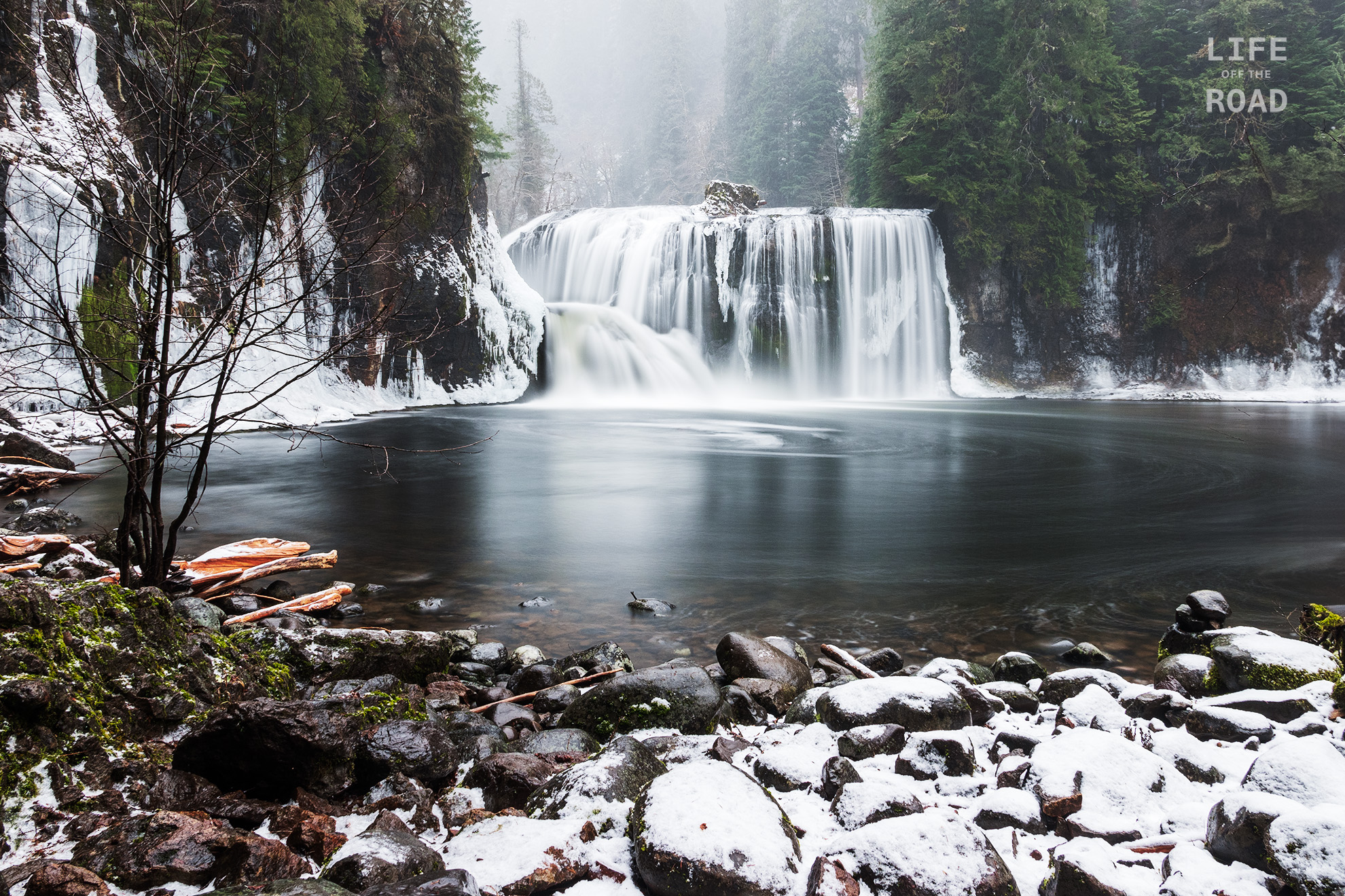
Upper Lewis River Falls
The Oregon side of the Columbia Gorge gets all the attention when it comes to waterfalls, and that is understandable because the Oregon side of the Columbia Gorge has its 1,000-foot-tall sheer cliffs, while the Washington side is a long, gradual, slope from the Cascade Mountains to the Columbia River. The Lewis River begins at Mount Adams, one of the volcanic triads of Mount Hood, Mount Adams, and Mount Saint Helens that dominate the region. The river parallels the Columbia for many miles, turning south and joining big-brother Columbia near Saint Helens, Oregon. Near Mount Adams where the Lewis still runs wild, is sports three impressive falls within a three-mile segment, that may not challenge the Oregon falls for height but absolutely trounce them with their impressive width. I was fortunate to catch the upper falls on a cold February day with intermittent snow and graupel. The photography gods were smiling on me, as there was a pause in the weather for the hour that I spent photographing the falls. It was a fantastic time. I love hiking in the winter and usually I am the only one crazy enough to challenge the trails in adverse weather, but on my way back to the lower falls I did run into a family heading to the upper falls. I greeted them and wished them a good day, but silently I tipped my hat to my fellow crazy winter hikers.