Jeep runs a fun program called the Jeep Badge of Honor Trail program that identifies a number of off-road trails around the country as “official” BoH trails for Jeeps, and uses a phone app that allows users to “check-in” to these trails and get credit for driving them. Jeep will also send you a nice-looking badge with the trail’s name, that you can stick onto the side of your Jeep, if you are into that sort of thing.
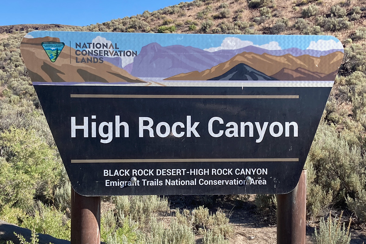
Tucked away in northwest Nevada is a newly designated Jeep BoH trail called High Rock Canyon. Seemingly in the middle of nowhere, this roughly 15-mile trail follows the 1846 section of the Applegate Trail along High Rock Creek. As Jeep trails go, this is a fun one with several water crossings as you travel along the creek, lots of interesting rock formations and colors from the different minerals leaching out of the rock, and a bit of sand. Jeep rates the trail a 3-4 is difficulty and I would say that is about right. It is probably closer to a 4 when the trail opens in May (higher water and mud) than it is in late June, which is when I ran the trail.
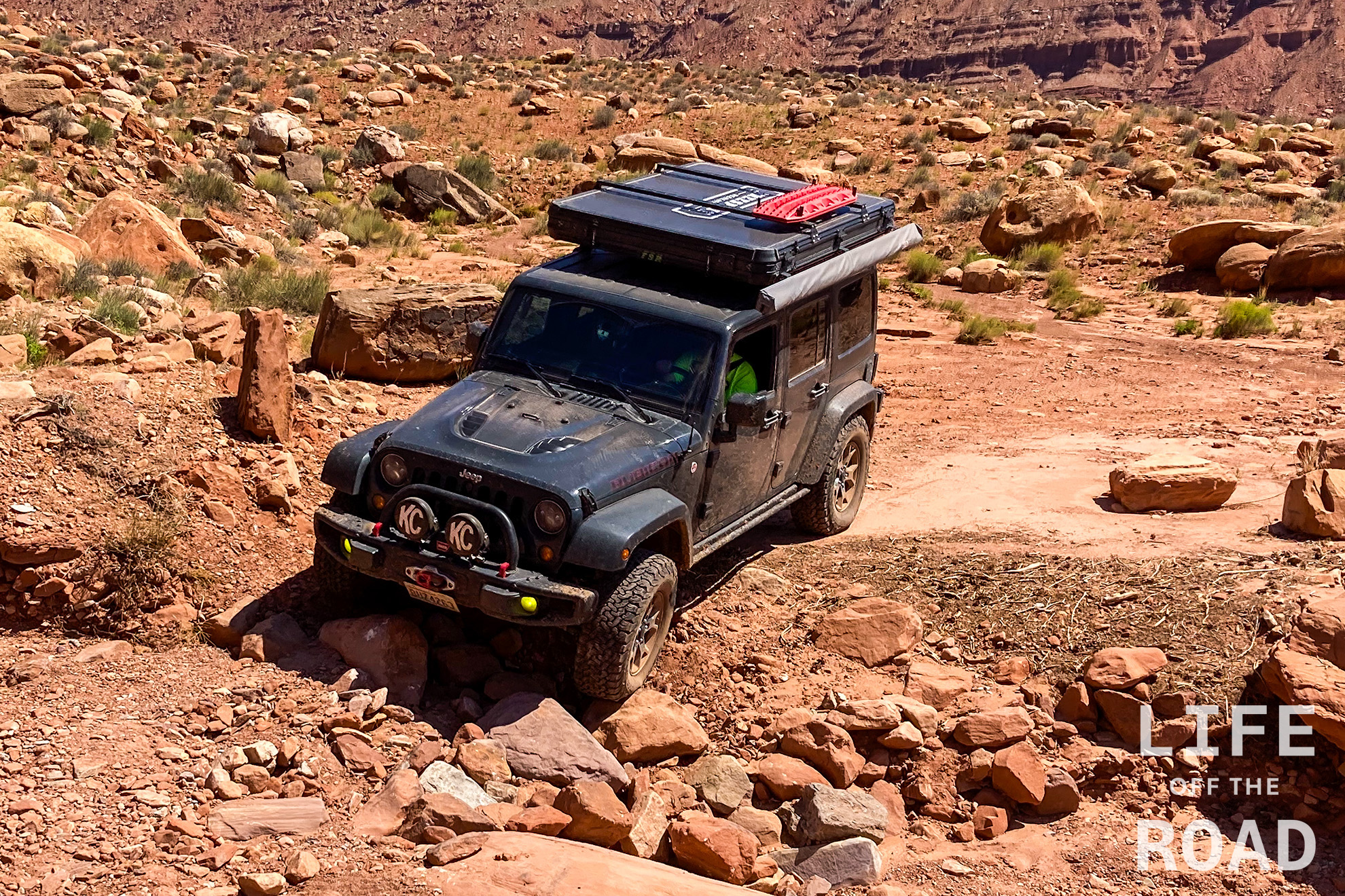
One of several water crossings along the High Rock Canyon Jeep Badge of Honor Trail
The wagon road roots of this trail are clearly evident in its narrowness and the way it meanders along the canyon shelves. It takes a good two hours to run the (roughly) 15-mile long trail, which speaks to the rugged terrain. It is not a technical trail, though, so massive tires and lockers are not required. A full tank of fuel will be very helpful.
Fox Homestead / Yellow Rock Canyon is about halfway through the trail, and camping is allowed here
You will want a plan to get from the northern end of the trail to wherever it is you intend to go. The primary road goes around the High Rock Canyon Wilderness to the west and connects to Road 34 / Leadville Road, which is a major thoroughfare. As I was headed home to Oregon, I followed the road north – northwest to Cedarville (roughly 55 miles from the end of the trail) and connected to the Northern California Backcountry Discovery Route at the intersection of Highways 299 and 395.
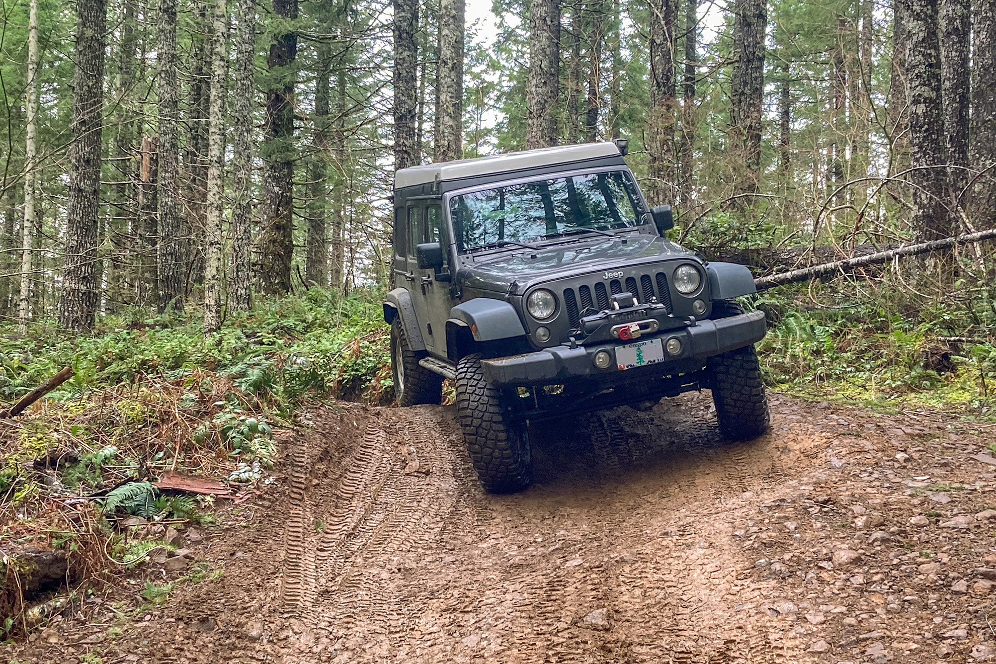
Last month during a rare break in the rain, I travelled over to the Tillamook State Forest and ran one of Jeep’s “Badge of Honor” trails, called Cedar Tree. With the rain mostly behind us, here in Oregon, I headed back over to the Tillamook State Forest on a Friday afternoon to run the second of the two Jeep BoH trails there, called “Firebreak 5.” Once our weather begins turning warmer and dryer, Tillamook State Forest becomes a bit crowded on the weekends, thus my Friday excursion and I was the only one on the trail. I imagine that Firebreak 5 might be a zoo on the weekends, as it can be run from both directions and there are very few spots to get off the trail in order to let others by. I had no idea which direction to run the trail, but picked south-to-north because Cedar Tree is “generally” a north-to-south trail, and that puts you right at the beginning of Firebreak 5.
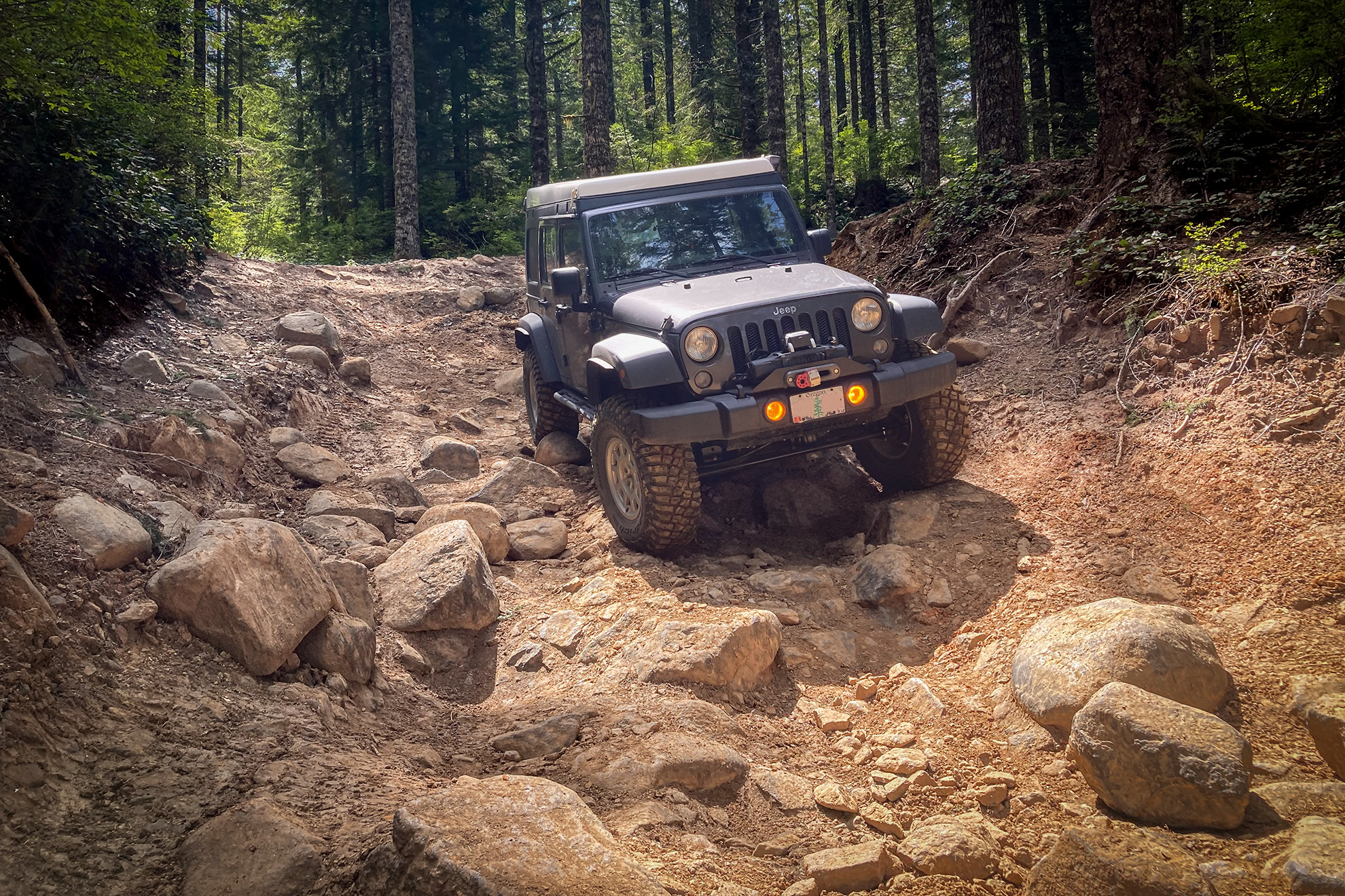
There are several pinch sections on Firebreak 5 that will challenge full-size vehicles
Spoiler alert: South-to-north on Firebreak 5 is all downhill, making the trail much easier than north-to-south. Easier does not mean “Cedar Tree” easy. Jeep rates Firebreak 5 a 5-7 vs. a 4 for Cedar Tree. In my opinion, Cedar Tree is a 3 and Firebreak 5 is a 4, perhaps a 4-5 if run north-to-south. It is a great trail for practicing rock crawling, though. Like Caine finally taking the pebble from Master Kan’s hand, when one can run Firebreak 5 without smacking the rear differential on a rock (I did not pass the test on this trip), one has achieved rock crawling zen. It is not that the rocks are huge, and there are not any stair step ledges, but everything is loose and your tires are prone to “kick out” and drop your rear differential onto a nascent boulder.
This view “down the chute” shows how Firebreak 5 is much easier when run south-to-north, which is all downhill
By my calculations on Gaia GPS, Firebreak 5 is a little over 2.4 miles long so about a half-mile shorter than Cedar Tree. Like Cedar Tree where you can add University Firepower onto the frontend of the trail for some additional distance, there is also Saddle Up that comes into Firebreak 5 from the south. Gaia or a similar mapping system is a must in order to work your way through the myriad of logging roads in the Tillamook State Forest, though once you are on the trails, they are well marked and easy to follow. Note that there is no wireless coverage in the area.
The last rocky chute on Firebreak 5 before exiting onto Beaver Dam Road
Like Cedar Tree, Firebreak 5 made for a quick afternoon escape into the woods. Going during the week was definitely a plus, as there was no traffic on the trail. When I did Cedar Tree on a Saturday morning, there were half-a-dozen other Jeeps and motorcycles on the trail – and that was during the wet season in March. If you have ever wanted to test your metal on some real rocks, Firebreak 5 is a great trail to begin honing your rock crawling skills.
Jeep runs a fun program called the Jeep Badge of Honor Trail program that identifies a number of off-road trails around the country as “official” BoH trails for Jeeps, and uses a phone app that allows users to “check-in” to these trails and get credit for driving them. Jeep will also send you a nice-looking badge with the trail’s name, that you can stick onto the side of your Jeep, if you are into that sort of thing. As a Jeep owner I had heard of the BoH thing but never paid much attention to it, until my trip across Utah with Dan, Mike and Adam. They wanted to spend a few days in Moab which is Jeep BoH Mecca, and get credit for a number of trails, there. We knocked-out four of the BoH trails while we were there, and several months later I received the little badges from Jeep, and I was hooked! Yes, I am easily amused.
They are not always this fast, but one week later my badge arrived via UPS
Fast-forward six months and in true Portland, Oregon fashion it has been raining for several weeks. Non-stop. Today, March 22nd however, I awoke to dry weather which gave me the itch to get my Jeep out and flex its new suspension and tires. Moab had convinced me that my Jeep needed to just a little bit taller, and the tires needed to be just a little bit bigger. That was my winter project. With a dry day in front of me, I decided that it would be a great opportunity to go run one of Oregon’s Jeep BoH trails, so I headed west towards the cheese town of Tillamook.
At some point on Highway 6 in the Oregon Coast Range Mountains there is a rather nondescript turnoff called Roger’s Camp Road. Fortunately, there is also a large state DOT gravel storage area at this point, making the road easier to spot. From here, you will need a good offline mapping application, as there is no mobile service in this area of the coast range, in order to find the trailhead, which in my case was called Cedar Tree. The road forks right becoming University Falls Road, and left becoming Beaver Dam Road.
University Falls is a short out-and-back hike
Either road will work, although I took Beaver Dam Road and then turned south onto the University Firepower trail which connects to Cedar Tree. University Firepower also connects to University Falls Road, so that right-fork would have also worked. The University Firepower trail has a tougher rating than Cedar Tree, and I can attest that even the short segment that I did, was a lot of fun. Particularly since it had been raining for several weeks. The trail was very steep and tight, with several very sharp turns, but even without engaging the lockers (because of the sharp turns), the new mud tires performed great.
Typical of the lower portion of Cedar Tree, although there are some squeeze-points between trees
After a mile of the University Firepower trail, it crosses a regular graveled logging road and the Cedar Tree trail begins. This trail is still tight with numerous trees, stumps, and roots crowding the trail, but there are no three-point turns like University Firepower. It is a fun and relaxing drive through coastal cedars and firs, and nothing that any capable four-wheel drive would have trouble, with. The Jeep BoH app rates Cedar Tree a 4 (with 1 being easiest and 10 being hardest). I would rate it a 3 or perhaps a 3-4.
Fallen cedar tree stump in the background
Towards the end of the trail, it pops-out onto a clear-cut landing where the infamous fallen cedar tree stump is located. Evidently one used to be able to drive under this tree, but the wet coastal mountains reclaim all the things, and the cedar tree is no exception. The trail ends near another Jeep BoH trail called Firebreak 5 and I will be back to run that one, someday.
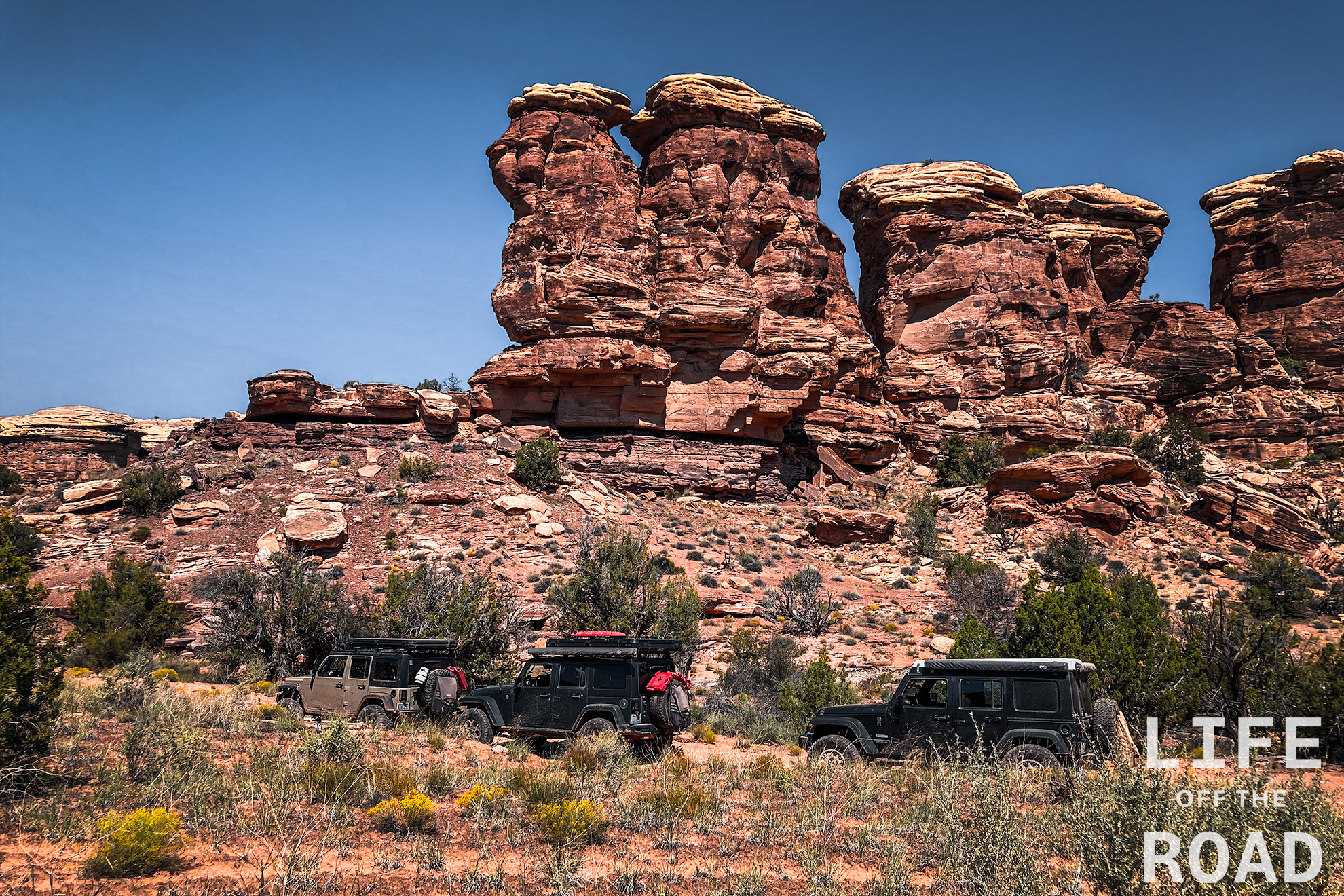
Elephant Hill is a Jeep Badge of Honor trail in Canyonlands National Park. It is 1 1/2 hours outside of Moab, so not nearly as popular, as the Moab trails. That being said, Elephant Hill was my favorite trail, and not one to be missed if you do not mind the drive. A permit is required for Elephant Hill, and the Park Service limits permits to 24 vehicles per day with a maximum group-size of three vehicles. The trail is about seven miles long, with most of the fun occurring in the first three miles. You know a switchback is tight, when you have to perform a three-point turn in a Jeep! But then the switchbacks got even tighter, requiring you to back down the trail until you reach an area wide enough to turn around. And you get to back up the trail, on the way back! That was a first, for me. The rest of the trail is standard rock benches and ledges, wash crossings, and a sandy valley floor. There is also a short spur road that runs out to the confluence of the Green and Colorado rivers.
Lockhart Basin Road connects Canyonlands National Park to Moab and is a designated alternate expert section of the Utah Backcountry Discovery Route. This road was no joke. Lockhart Basin Road was my introduction to rock crawling. I thought that I had rock crawled in my Jeep before, but I was greatly mistaken. It is an amazing route, as you might imagine, since it runs along Canyonlands. It begins in Canylands as a nice, wide, graveled road that gradually becomes narrower as you wind your way up into the rocky canyons of Bears Ears National Monument. Towering red cliffs on the right, vast expanses of picturesque Canyonlands on the horizon, to the left. At some point, and it sneaks up on you quickly, the road turns into a series of boulder-strewn, narrow passages, that will make you wonder what you have gotten yourself into.