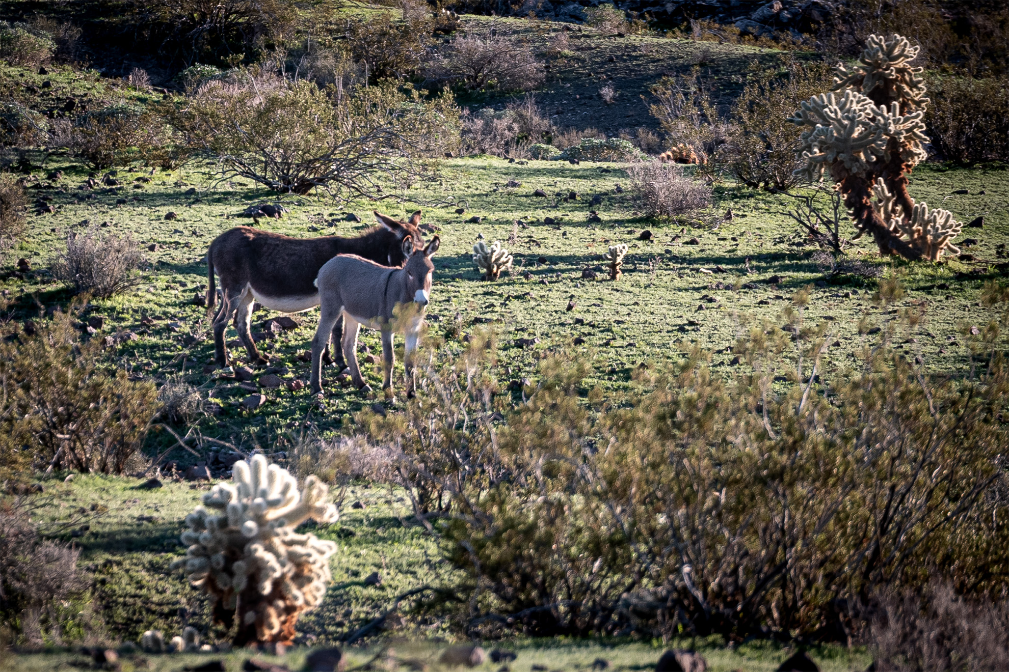
I recently spent the night outside of Oatman, Arizona and had a few guests meandering around my campsite, which was well off the beaten path in a box canyon. These two were very quiet, but other burros in the area were bellowing all night long.
Tag: Nature Photography
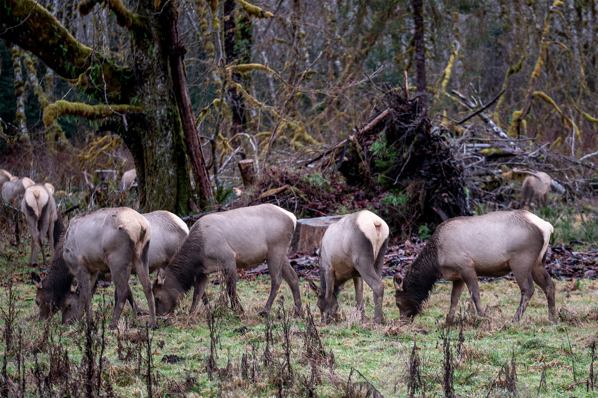
Wherever I am, one of my goals is to always try and capture something with the camera that reminds me of the journey.
-
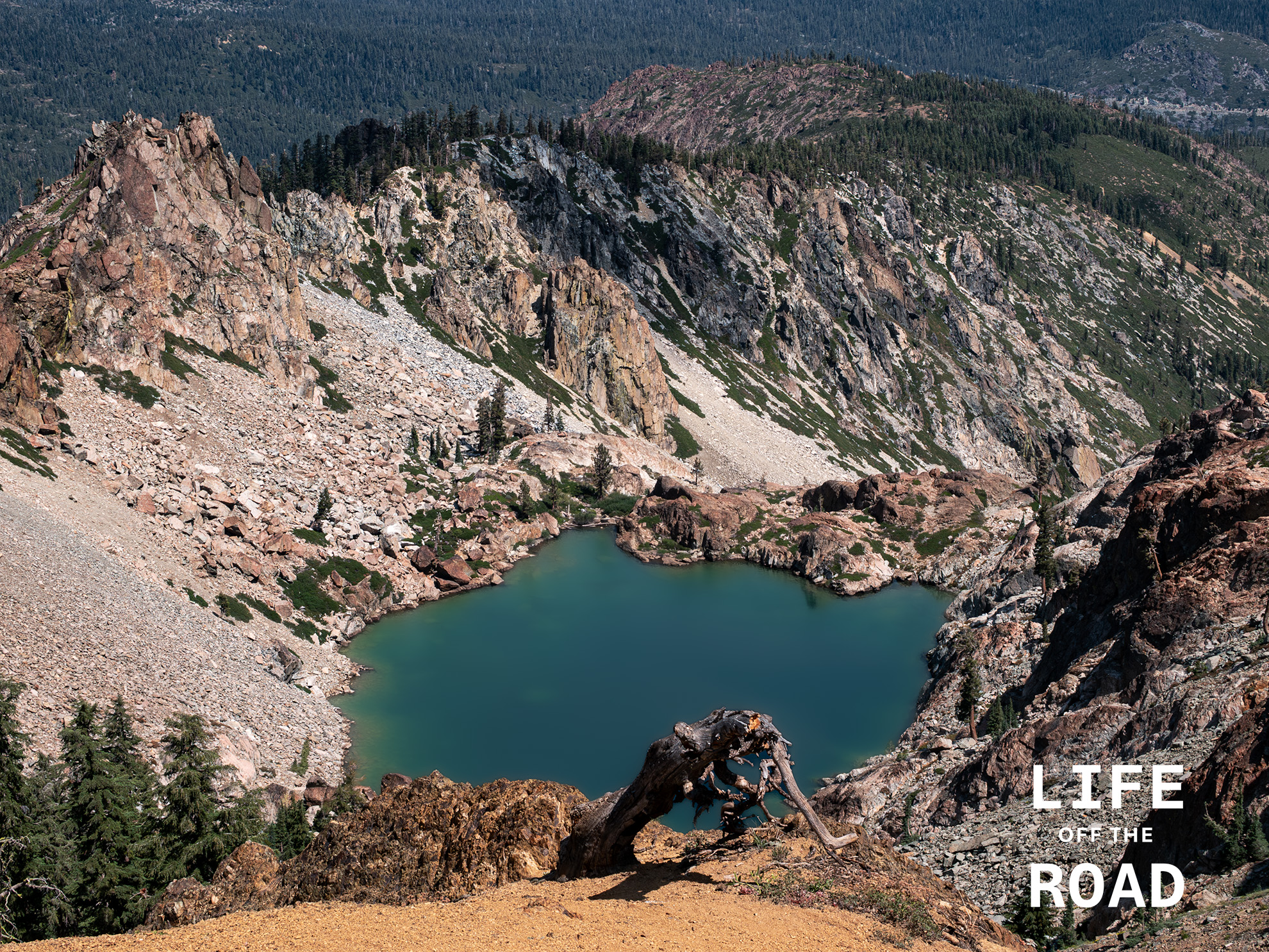
Young America Lake
Young America Lake sits high in the Sierra Buttes above Sierra City, California and is only visible from high-up in the Buttes. Likely named for the Young America Mine, which was one of Sierra County’s richest gold mines in the late 1800’s. This spot is accessible via the Sierra Buttes Lookout Trail which crosses the Pacific Crest Trail, just over the ridgeline one the left-side of the photo, or via a somewhat harrowing wagon road named Sierra Buttes Road, which climbs (rapidly) out of Sierra City. Acrophobic’s beware.
-
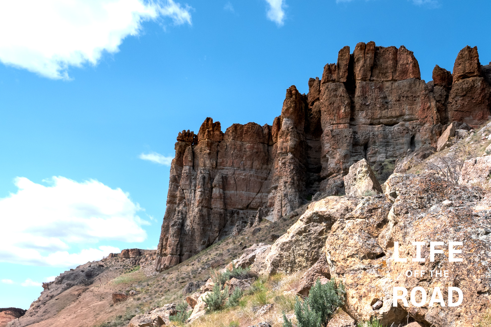
John Day National Monument – Clarno Unit
Imagine Eastern Oregon as a steamy, humid landscape filled with diverse plant life. That’s the scene the Clarno Unit’s fossils paint. The area’s unique geology, a result of volcanic activity, is the reason these fossils are so well-preserved. Massive volcanic mudflows, known as lahars, swept through the landscape, entombing plants, nuts, and even the remains of ancient mammals in their path. These events created a “snapshot” of a bygone ecosystem, capturing life in a moment of time.
Most people have heard about Oregon’s famous Painted Hills, but few venture outside that area of the John Day National Monument, to the Clarno or Sheep Rock units. The Clarno Unit is very compact, with easy trails that wind their way in and around rockfall from the tall spires of the ancient lahars, towering above. Numerous examples of the ancient flora and fauna can be seen captured in the ancient mudflows, along the trail. Numerous interpretive signs along the trails point to specific fossils features within the rock, or explain the natural conditions of the area, at the time. In this arid area of Oregon, it is difficult for us to imagine early elephants wandering about the forested savannah of what is now Eastern Oregon.
-
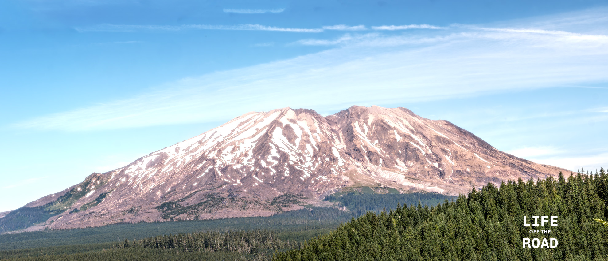
Mount St. Helens
Having lived in Oregon for much of my life, and having experienced the eruption of Mount St. Helens in 1980 (albeit as a freshman in high school!), I am a bit chagrined to admit that I have never visited the mountain. Researching places to photograph the mountain, I came across Lahar Viewpoint in the Gifford Pinchot National Forest. The viewpoint was interesting and I did get some pictures there, but the forest is returning to the area, making clear views of the mountain a challenge. Just up the road (Forest Road 83) perhaps 1/4 mile from the viewpoint is a bridge over what must have been the path of the mudflow (“lahar”) from the volcano, which is now a small stream. Fortunately, the bridge has a sidewalk, offering a safe place to setup the tripod for some of the clearest views of the south side of Mount St. Helens. This photograph is not from that spot, although I did take some good ones from the bridge! I stumbled on the location of this photograph on my way home, on a spur road off of another forest road – where I ran into a locked gate, and had to double back towards the main Forest Road 83. While doubling back, I took several side roads to see if they might get me around the locked area, but no luck. On one of those roads, however, I came upon this stunning view of the mountain. Sometimes it is better to be lucky, I guess!
-
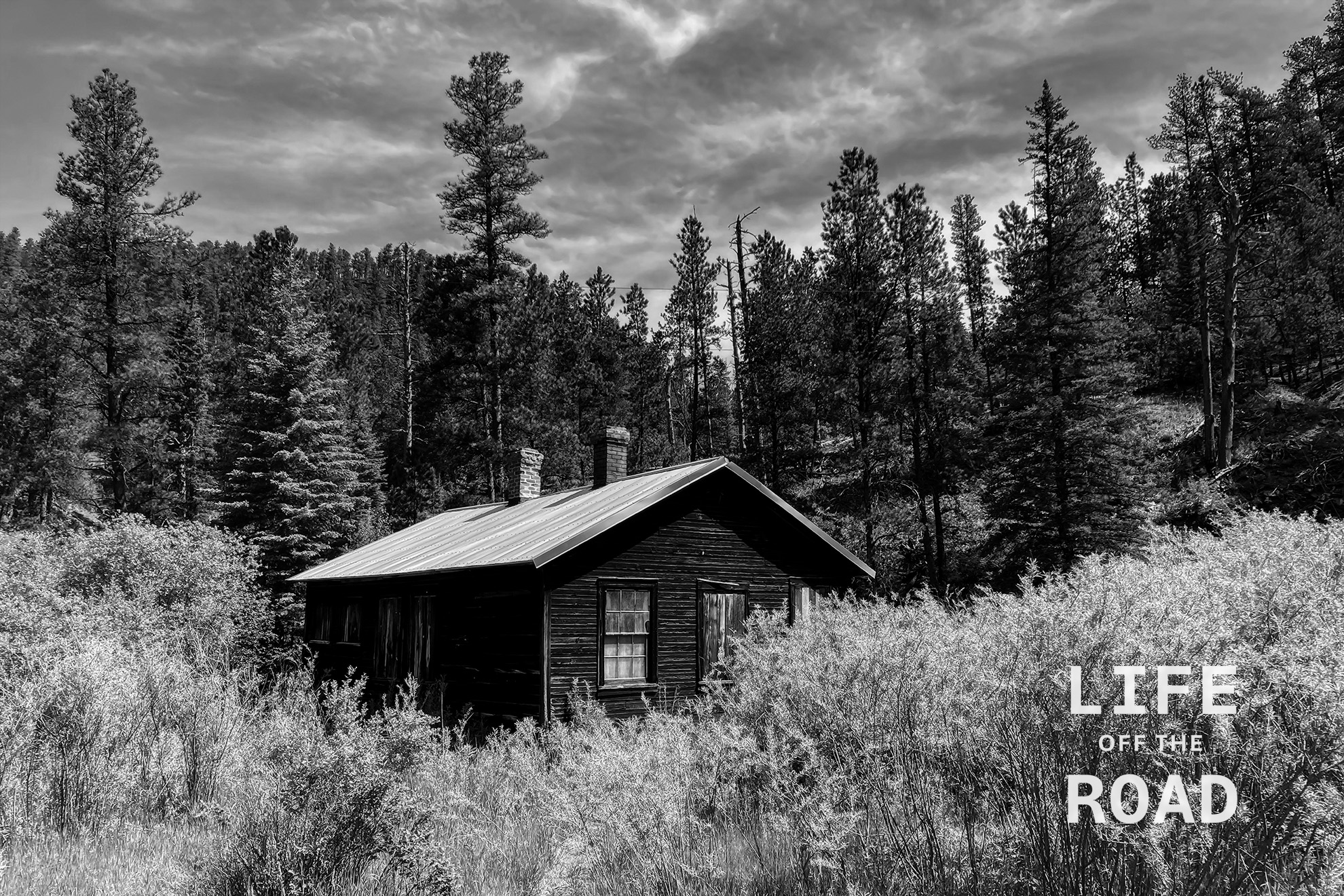
Mystic, South Dakota
Mystic is a ghost town in the Black Hills of South Dakota. Originally a gold mining encampment called Sitting Bull, in 1876, the (now) town changed its name to Mystic in 1889. After the turn of the century, Mystic became more of a lumber town than a mining town, and remnants of the old sawmill – like this building – remain in the area.
-
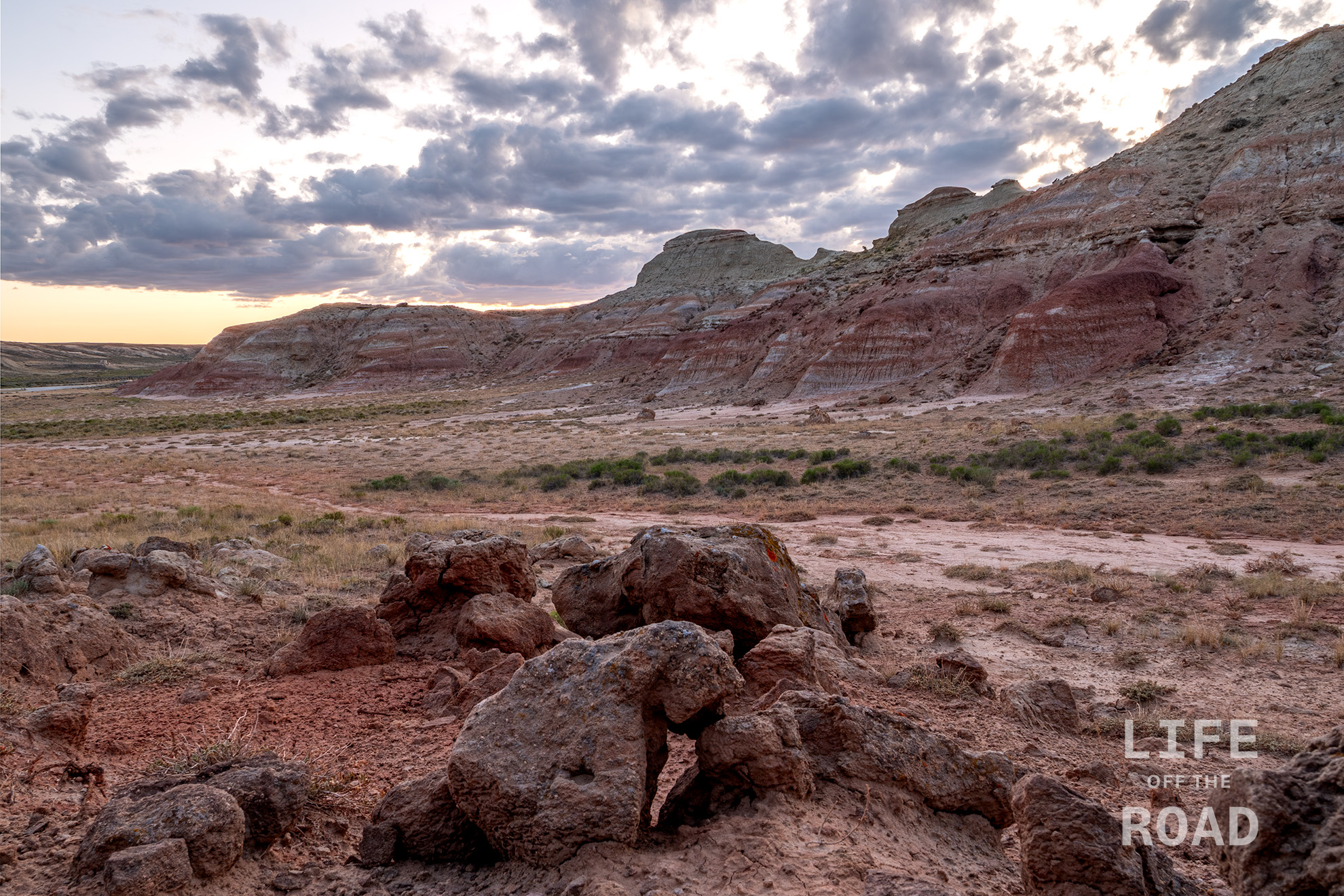
Wyoming’s Red Desert
Last week, I journeyed with Adam from Seattle and Dan from San Diego, through the Black Hills of South Dakota and the Red Desert, in Wyoming. I have to confess that I have never heard of the Red Desert, so it was quite a treat to trek around this southern portion of the state. Pronghorn were everywhere, and the terrain was quite spectacular.
-
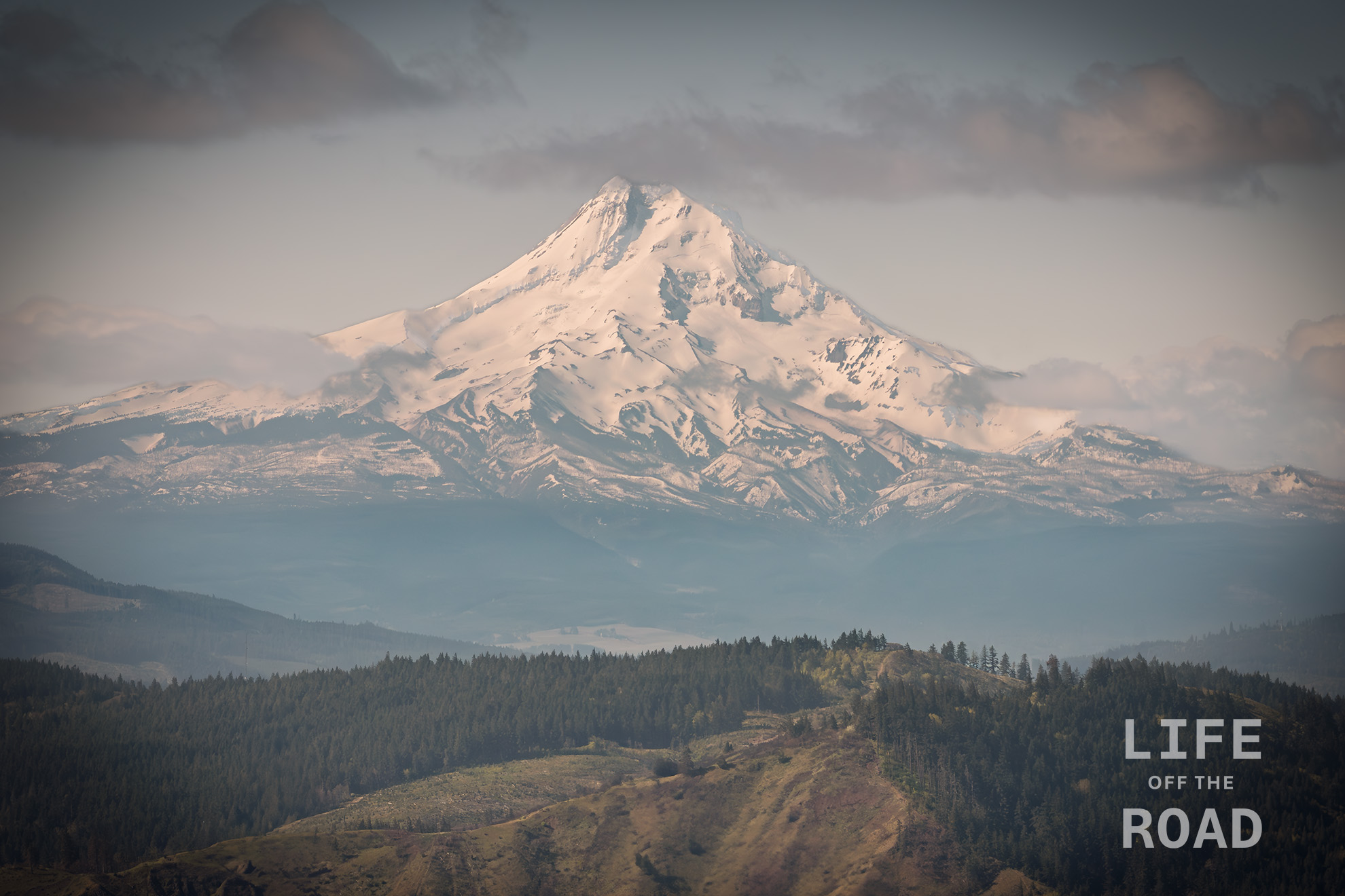
Mount Hood from Washington
Opportunities to capture a fully-snowcapped Mount Hood are winding down, as Government Camp will hit 80f / 27c today. In late April I was over on the Washington side of the Columbia River in the hills above White Salmon and captured this view of Mount Hood.
-
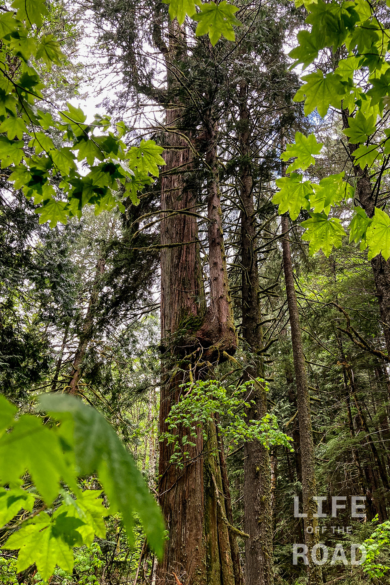
The Giants of Lost Creek
I recently stumbled on a 2015 newspaper article about a 170-acre section of old-growth timber semi-secured away along a tiny, secondary tributary in the Gifford Pinchot National Forest, called Lost Creek. There is old-growth timber in at least several places, in Gifford Pinchot. This past winter I hiked the Lewis River Trail which had a plethora of old-growth fir and cedar along the route, including a monster Douglas Fir between the middle and upper falls that rivaled the ones I could find on this trip. Old growth timber is fairly rare in northwest Oregon due to logging (of course) and forest fires, like the Tillamook Burn. These trees do not grow forever, though, and there is a massive fir tree along Lost Creek that is dead, with huge carvings of bark falling off around the tree, onto the ground. This area, like many along the creek with leaning trees propped-up by others, are somewhat dangerous and should be respected.

The forest floor along Lost Creek in the Gifford Pinchot National Forest Unlike Lewis River, Cedar Flats, or several other well-publicized locations of old-growth trees, the stand along Lost Creek has a much more remote and primitive feeling. It is still the Pacific Northwest with all of its moss and decay, but there is a “lost in time” feeling when traveling through the area, which I do not think was just my imagination. It is part of the fascination with this area, and not one that I felt while hiking along the Lewis River – even though some of the trees were just as spectacular. This area along Lost Creek is old and untouched, and you can feel it.

My pathetic attempt at demonstrating the width of a Douglas Fir along Lost Creek. My arm span is 6′ 4″ / 193cm, but of course I did not get centered on the tree! This is why I am an amateur… This was my second outing to Lost Creek, the first time being on the south-side of the creek. To be honest, I am probably going to go back, just because it is such an untouched and remote place. Ironically, the Washington Backcountry Discovery Route runs right by it, but there is nothing to make you think there might be something more lurking off in the woods. Perhaps you might see a Toyota Prius parked there, on this fairly pot-holed and rough logging road. There was one parked there, last Sunday.
-
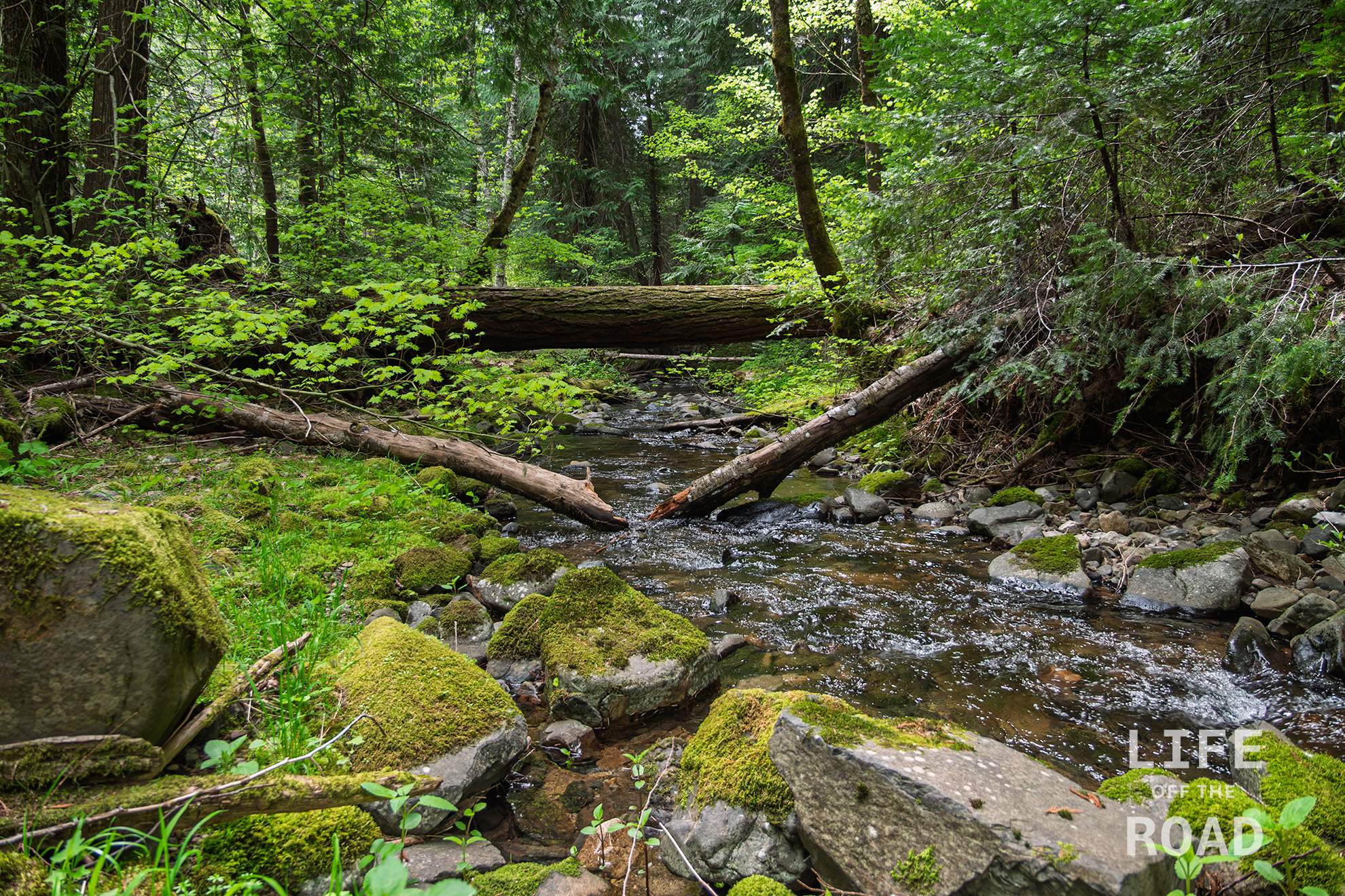
Lusk Creek
I had spent the day exploring some areas in the Gifford Pinchot National Forest and was returning home on Forest Road 86, which runs along Lusk Creek, when this fairytale view stopped me in my tracks.
-

Oregon’s Painted Hills
Travel Oregon has a list of seven natural wonders in Oregon, and the Painted Hills unit of the John Day Fossil Beds National Monument is one of them. The others are Crater Lake, the Columbia River Gorge, Mount Hood, Smith Rock State Park, the Wallowa Mountains, and the Oregon Coast. I am a bit chagrined to admit that I have not been to the Painted Hills, or any of the other areas that comprise the John Day Fossil Beds National Monument, so I decided to remedy that with a day trip.

The three units of the John Day Fossil Beds National Monument The John Day Fossil Beds NM is actually three separate locations, with the Painted Hills unit being the popular one that the majority of people visit. In addition, there is the Clarno Unit forty-five miles to the north, and the Sheep Rock unit, forty-five miles to the east. The Painted Hills unit is two hundred miles from Portland, making this a challenging day trip!
I arrived at the Painted Hills in the morning and headed up the Carroll Rim Trail which gains about two hundred feet, providing one of the best views of the Painted Hills area. There are numerous other trails that branch out along the base of the hills, for equally impressive close-up views.
I did not have enough time to include the Sheep Rock unit on this trip, but I did visit the Clarno unit on the way home. Unlike the smooth multi-colored hills, the Clarno unit is an ancient volcanic mudflow that has eroded away into tall spires. It reminded me of the Needles District in Canyonlands National Park. Since this was a mudflow, though, there are the fossilized remains of plant material in nearly every rock. For my untrained eyes, the fossils were not always easy to see. The rocks formed by the 45-million-year-old mud are weathered and covered with lichens, camouflaging the fossilized leaves. Fortunately, the park has numerous signage along the trails, pointing-out specific fossils.
-
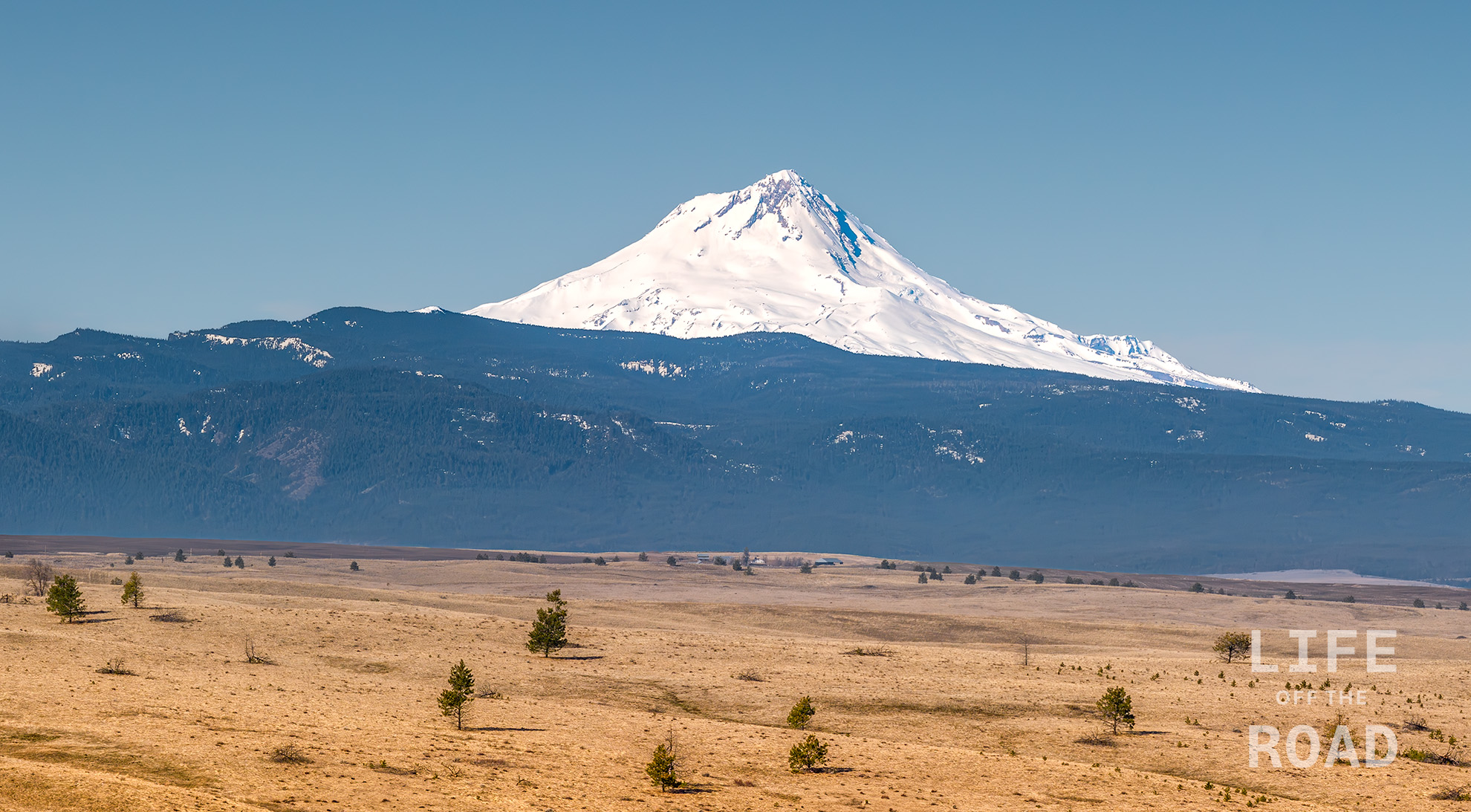
Mount Hood
Mount Hood is Oregon’s highest mountain, at 11,249 feet, and one of three active volcanoes around the Columbia Gorge; Mount St. Helens last erupted in 1980, Mount Hood in the 1790’s, and Mount Adams around 1000. These mountains are part of the Cascade Volcanic Arc, stretching from British Columbia to Northern California. This arc also forms a demarcation between the Pacific Ocean-facing western side with its lush rainforests, and the arid eastern side shown here, with less than 20-inches of annual rainfall.