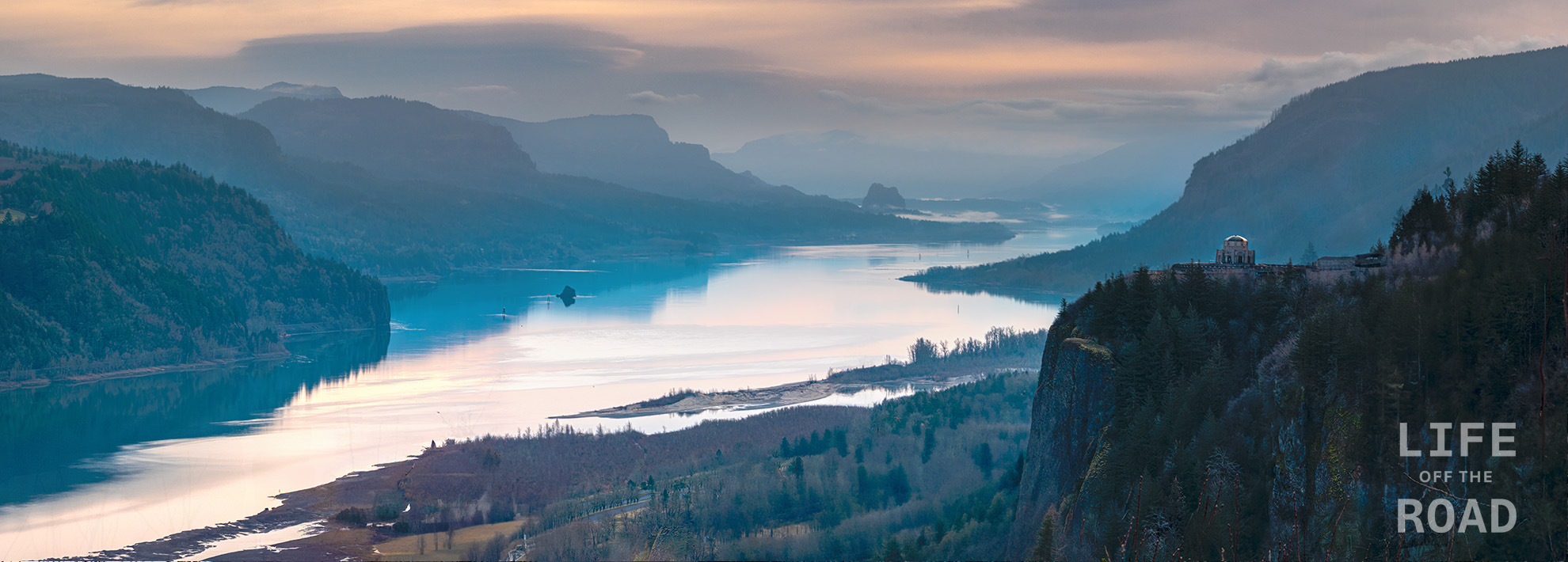
The Columbia Gorge is one of the most geologically impressive features in North America, forming a deep path through the Cascade Mountains for the Columbia River – the largest river flowing into the Pacific Ocean from North America. The river was not always where it is today, having been pushed north by lava flows on the Oregon side, and more recently, pushed back south and even blocked, by enormous landslides from the Washington side. The layers of lava flows, reminiscent of frosted layers in a cake, form the steep cliffs on the Oregon side of the gorge providing a waterfall-rich environment between Troutdale, at the western mouth of the gorge just east of Portland, and Hood River. From the Portland Women’s Forum scenic viewpoint where this photo was taken, easily-accessible waterfalls along the Historic Columbia River Highway include Latourell Falls, Shepperd’s Dell Falls, Bridal Veil Falls, Wahkeena Falls, Multnomah Falls, and Horsetail Falls.
Tag: Nature Photography
Wherever I am, one of my goals is to always try and capture something with the camera that reminds me of the journey.
-
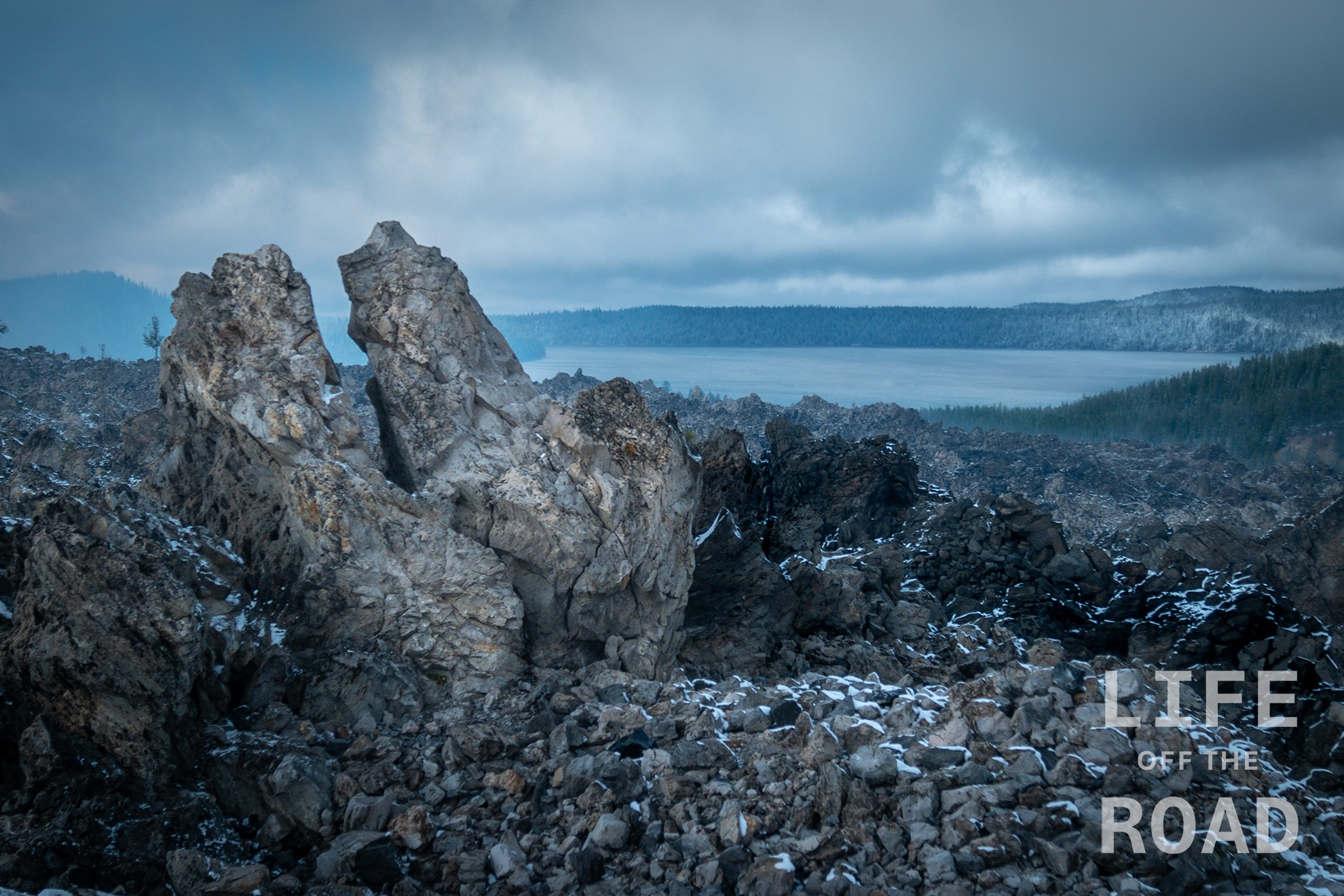
Paulina Lake
Crater Lake is one of several lakes in Oregon that reside inside volcanic calderas. The Newberry Volcano erupted some 75,000 years ago and subsequently collapsed, forming a five-mile diameter caldera. Newberry is much older than the 7,500-year-old Mount Mazama Caldera, containing Crater Lake. The Newberry Caldera is located 20-miles south of Bend, Oregon, and contains Paulina Lake and East Lake. Paulina Lake is the larger of the two, encompassing 1,530 acres and a depth of 250-feet. Like Crater Lake, Paulina and East Lake rely on snowmelt and rain, and Paulina Lake also has hot springs that feed it. Newberry remains active and its most recent eruption formed Big Obsidian Flow, a 1,300-year-old lava flow, the youngest in the state. This photograph is from the top of Big Obsidian Flow, with Paulina Lake in the distance.
-
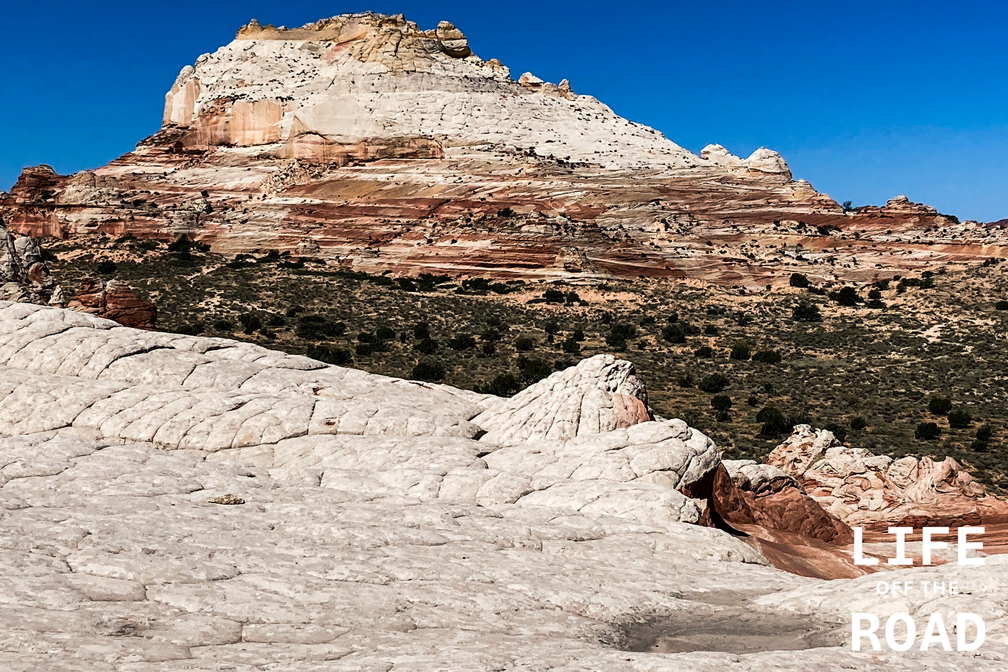
White Pocket
A challenging place to reach, White Pocket on the Arizona – Utah border is an impressive area of sandstone formations.
-
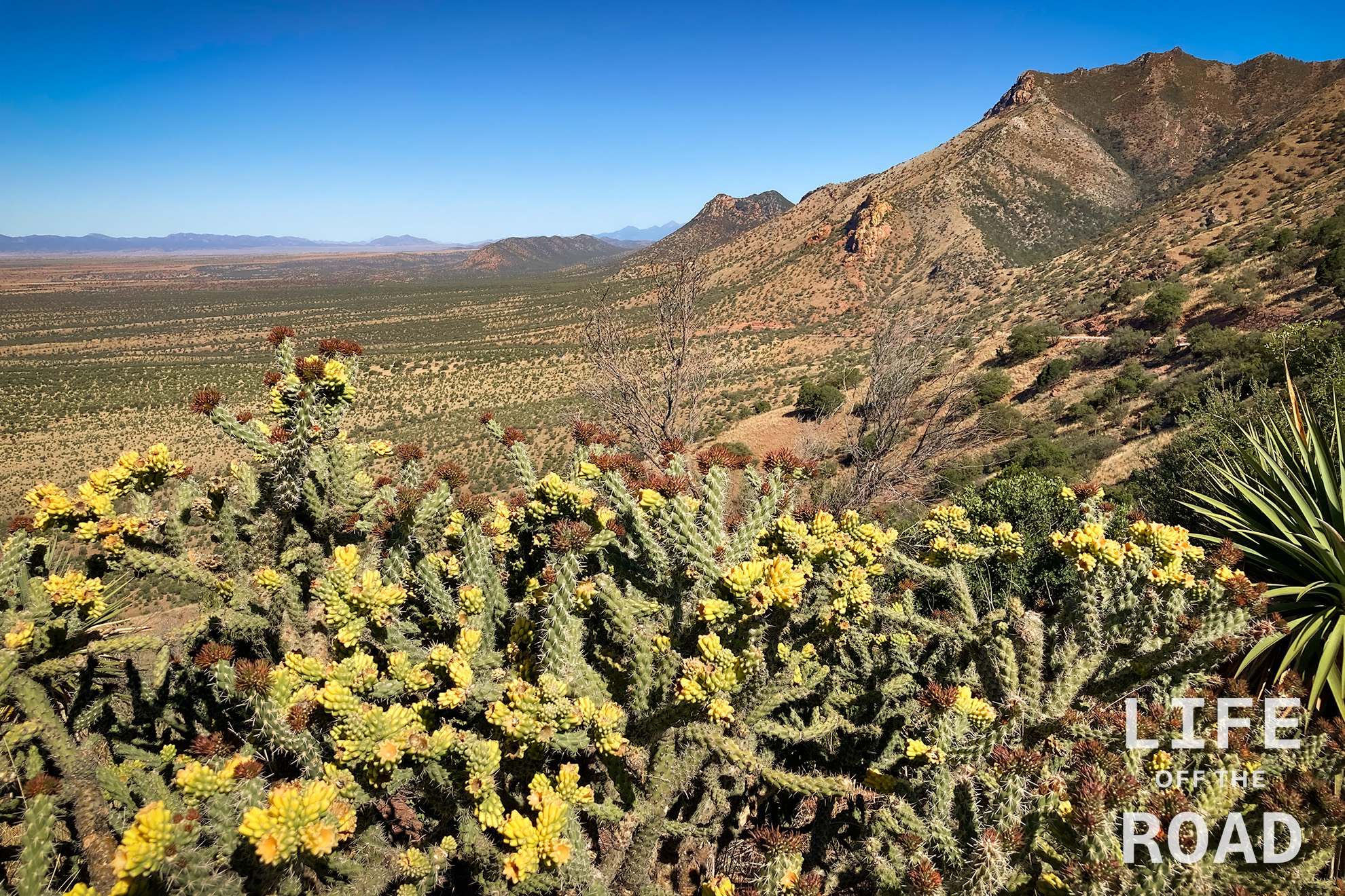
Coronado National Monument
We began our journey across Arizona in the Coronado National Monument on Montezuma Canyon Road, heading up to Montezuma Pass. It was a clear morning in early May, with stunning views all the way into Mexico.
-
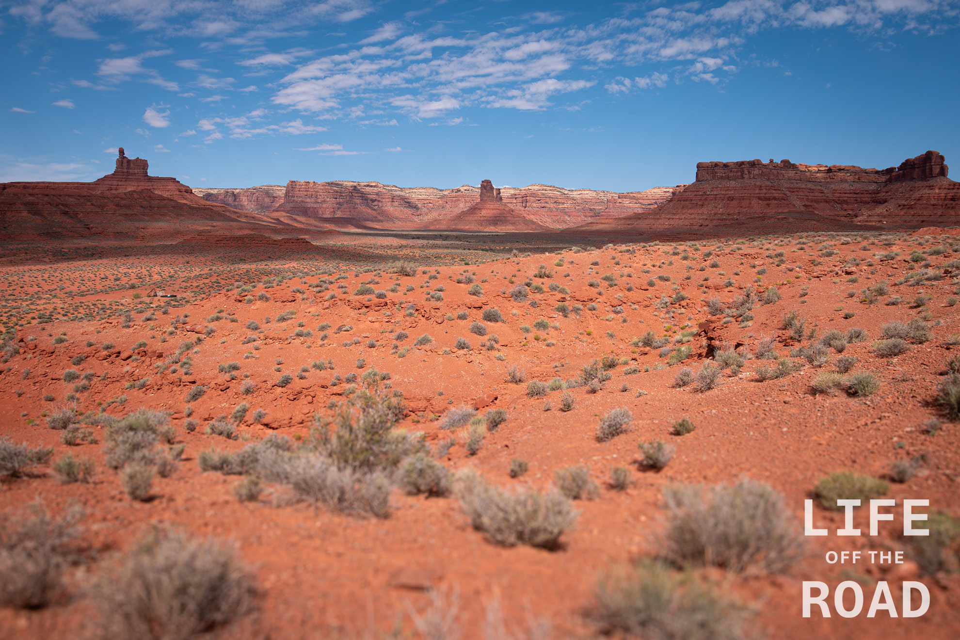
Valley of the Gods
Valley of the Gods does not get near the attention of neighboring Monument Valley, but that is part of the charm of this southern Utah wonderland. Particularly during the week, you might only see a handful of other people along the 17-mile route cutting through the valley. It is BLM land, so there will be campers, but mostly on weekends. There are no services and no campfires allowed.
-
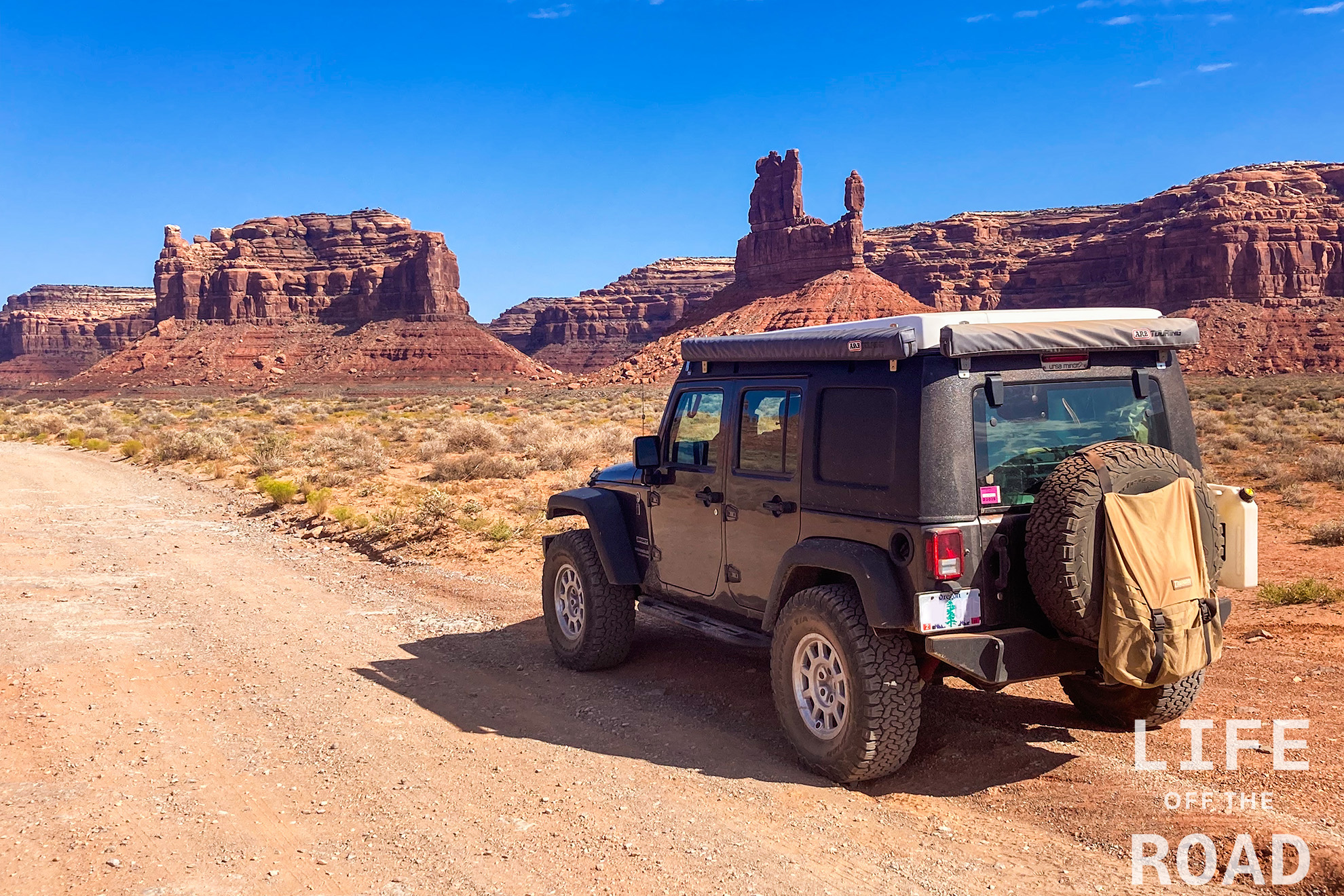
Valley of the Gods
Valley of the Gods is a great little park located south of Bluff, Utah off highway 163. It is also accessible from the west via highway 261. A seventeen-mile road runs through the park, connecting the two highway entrances. The road is accessible to most vehicles, but like many semi-improved roads in the southwest, is crosses several washes that will challenge any vehicle that does not have ground clearance for off-road travel. I made several trips through the park. Even though it is smaller than the more popular locations, like Monument Valley or Canyonlands, it is no less stunning and I found myself stopping every five minutes to take-in a new sight, or get a different perspective on a feature.
-
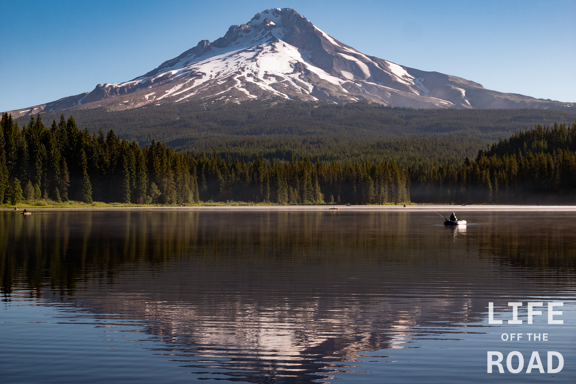
Trillium Lake
Trillium Lake is a man-made lake at the base of Mount Hood, in Oregon. This shot is from the south end of the lake, drive past the campground towards the day use area.